
IMAGES TAKEN NEAR TO
Dorrington Road, LANCASTER, LA1 4TD
Introduction
This page details the photographs taken nearby to Dorrington Road, LA1 4TD by members of the Geograph project.
The Geograph project started in 2005 with the aim of publishing, organising and preserving representative images for every square kilometre of Great Britain, Ireland and the Isle of Man.

There are currently over 7.5m images from over14,400 individuals and you can help contribute to the project by visiting https://www.geograph.org.uk
Image Map
Images are licensed for reuse under creativecommons.org/licenses/by-sa/2.0
Notes
- Clicking on the map will re-center to the selected point.
- The higher the marker number, the further away the image location is from the centre of the postcode.
Image Listing (57 Images Found)
Images are licensed for reuse under creativecommons.org/licenses/by-sa/2.0
Image
Details
Distance
1

Greaves. Lancaster
Looking towards the castle on the skyline from the road behind St. Paul's church.
Image: © Michael Graham
Taken: 22 Dec 2009
0.09 miles
2

From Ripley Heights
Looking over Greaves and Bowerham from the pasture on Ripley Heights. Heather burning on Clougha Pike on the horizon
Image: © Michael Graham
Taken: 13 Feb 2008
0.09 miles

4

St. Paul's Scotforth
The scene of my first marriage many moons ago.
Image: © Michael Graham
Taken: 22 Dec 2009
0.10 miles
5
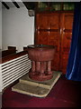
St Paul's Parish Church Scotforth, Font
Image: © Alexander P Kapp
Taken: 23 Jul 2008
0.10 miles
6
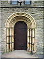
St Paul's Parish Church, Scotforth, Doorway
Image: © Alexander P Kapp
Taken: 23 Jul 2008
0.11 miles
7

Jamea Al Kauthar Islamic College (formerly Royal Albert Hospital)
This grand building fronting onto Ashton Road is the former Royal Albert Hospital. It opened in 1870 as 'Royal Albert Idiot Asylum for idiots and imbeciles of the seven northern counties' https://historicengland.org.uk/listing/the-list/list-entry/1194930 . Following legislation in the 1980s, the patients were relocated in the community, and the hospital closed in 1996. The building was then acquired by Jamea Al Kauthar Islamic College to provide Islamic education for girls. The main part of the hospital is recorded in the National Heritage List for England as a designated Grade II* listed building (Historic England List Entry Number: 1194930 https://historicengland.org.uk/listing/the-list/list-entry/1194930 ).
Image: © David Dixon
Taken: 17 Mar 2019
0.11 miles
8
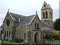
St Paul's Parish Church, Scotforth
Image: © Alexander P Kapp
Taken: 23 Jul 2008
0.11 miles
9
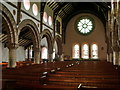
St Paul's Parish Church, Scotforth, Interior
Image: © Alexander P Kapp
Taken: 23 Jul 2008
0.11 miles
