
IMAGES TAKEN NEAR TO
Bishopsgate, LANCASTER, LA1 4QF
Introduction
This page details the photographs taken nearby to Bishopsgate, LA1 4QF by members of the Geograph project.
The Geograph project started in 2005 with the aim of publishing, organising and preserving representative images for every square kilometre of Great Britain, Ireland and the Isle of Man.

There are currently over 7.5m images from over14,400 individuals and you can help contribute to the project by visiting https://www.geograph.org.uk
Image Map
Images are licensed for reuse under creativecommons.org/licenses/by-sa/2.0
Notes
- Clicking on the map will re-center to the selected point.
- The higher the marker number, the further away the image location is from the centre of the postcode.
Image Listing (10 Images Found)
Images are licensed for reuse under creativecommons.org/licenses/by-sa/2.0
Image
Details
Distance
1
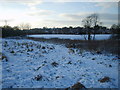
Barton Road Field
Looking over Burrow Beck towards Barton Road.The dog in shot is a guide dog whose owner has not been able to venture out on the frozen pavements for a while.
Image: © Michael Graham
Taken: 9 Jan 2010
0.10 miles
2

Moorside School Field
The scene of many footballing triumphs in 1966. The school seen in the distance
Image: © Michael Graham
Taken: 1 Jan 2009
0.13 miles
3

Burrow Beck, Scotforth
Probably an artificial channel as it's so straight just here
Image: © Karl and Ali
Taken: 21 Dec 2009
0.14 miles
4

The 'Racecourse' Estate
Known locally as ' The Racecourse' as the land was originally owned by the Cousins family who had racehorses. Anyroadup all the streets on this estate built in the late 60's early 70's had to be named after racecourses. This is Newmarket Avenue I think. Whilst the maps label this area as Scotforth it is really Hala or possibly Newlands to locals.
Image: © Michael Graham
Taken: 1 Jan 2009
0.15 miles
5

Path along the top of new flood defences near Lentworth Drive
Image: © shikari
Taken: 7 May 2025
0.15 miles
6

The School Path
Well that's what we used to call it when we were kids. Links Bowerham Road with Hala Carr and runs by Moorside Primary School. The small beck running by the fragment of old woodland feeds into Burrow Beck near Barton Road
Image: © Michael Graham
Taken: 1 Jan 2009
0.18 miles


9

Hala Hill
From here on a clear day you can see over the bay to the Lakeland hills
Image: © Michael Graham
Taken: 1 Jan 2009
0.24 miles
10

Bowerham Road
A cheery sight for early morning motorists
Image: © Michael Graham
Taken: 22 Dec 2009
0.25 miles