
IMAGES TAKEN NEAR TO
Nelson Street, BARROW-IN-FURNESS, LA14 5TB
Introduction
This page details the photographs taken nearby to Nelson Street, LA14 5TB by members of the Geograph project.
The Geograph project started in 2005 with the aim of publishing, organising and preserving representative images for every square kilometre of Great Britain, Ireland and the Isle of Man.

There are currently over 7.5m images from over14,400 individuals and you can help contribute to the project by visiting https://www.geograph.org.uk
Image Map
Images are licensed for reuse under creativecommons.org/licenses/by-sa/2.0
Notes
- Clicking on the map will re-center to the selected point.
- The higher the marker number, the further away the image location is from the centre of the postcode.
Image Listing (71 Images Found)
Images are licensed for reuse under creativecommons.org/licenses/by-sa/2.0
Image
Details
Distance
1
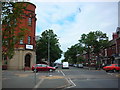
Hartington Street
A leafier road than usual in this part of town. The building with the round tower on the corner of Nelson Street was once a church. The spire that once topped the tower has long gone.
Image: © Rosalind Mitchell
Taken: 5 Jul 2007
0.05 miles
3
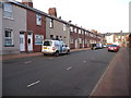
Vernon Street, Hindpool, Barrow-in-Furness
Newer houses have been inserted into the far end of the terrace.
Image: © Christine Johnstone
Taken: 2 Feb 2015
0.07 miles
5
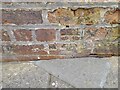
Ordnance Survey Cut Mark
This OS cut mark can be found on the NE face of the Methodist Chapel.
Image: © Adrian Dust
Taken: 23 Feb 2022
0.08 miles
6
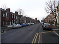
Hartington Street, Hindpool, Barrow-in-Furness
Trees, front gardens and bay windows mean that these houses were originally built for families with higher incomes. Supervisors, office staff, perhaps even managers. Average income families lived in houses without these status symbols.
Image: © Christine Johnstone
Taken: 2 Feb 2015
0.09 miles
7
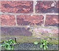
Ordnance Survey Cut Mark
This OS cut mark can be found on No5 Bath Street. It marks a point 9.719m above mean sea level.
Image: © Adrian Dust
Taken: 28 Mar 2018
0.09 miles
8
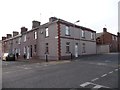
Hawke Street, at the junction with Bath Street
The Hindpool area of Barrow-in-Furness is a grid-iron pattern of terraced streets.
Image: © Christine Johnstone
Taken: 2 Feb 2015
0.11 miles
9
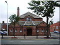
Ramsden Hall, Abbey Road, Barrow-in-Furness
Image: © Alexander P Kapp
Taken: 31 Jul 2007
0.12 miles
10
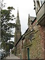
St. Mary of Furness Church at Barrow-in-Furness
St. Mary of Furness Church stands in Duke Street. Designed by E.W. Pugin (1834–1875) on a site donated by the Duke of Devonshire, the Church was built during 1866-7 and opened for worship 28 August 1867. Its fine spire was added in 1888.
Image: © Gerald Massey
Taken: 22 Sep 2009
0.12 miles