
IMAGES TAKEN NEAR TO
Emmanuel Court, BARROW-IN-FURNESS, LA14 5HA
Introduction
This page details the photographs taken nearby to Emmanuel Court, LA14 5HA by members of the Geograph project.
The Geograph project started in 2005 with the aim of publishing, organising and preserving representative images for every square kilometre of Great Britain, Ireland and the Isle of Man.

There are currently over 7.5m images from over14,400 individuals and you can help contribute to the project by visiting https://www.geograph.org.uk
Image Map
Images are licensed for reuse under creativecommons.org/licenses/by-sa/2.0
Notes
- Clicking on the map will re-center to the selected point.
- The higher the marker number, the further away the image location is from the centre of the postcode.
Image Listing (88 Images Found)
Images are licensed for reuse under creativecommons.org/licenses/by-sa/2.0
Image
Details
Distance
2
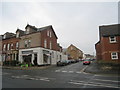
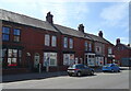
The corner of Ainslie Street and Warwick Street
Image: © Jonathan Thacker
Taken: 29 Oct 2010
0.03 miles
4
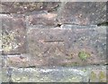
Ordnance Survey Cut Mark
This OS cut mark can be found on the park wall SE side of Abbey Road. It marks a point 20.635m above mean sea level.
Image: © Adrian Dust
Taken: 28 Mar 2018
0.04 miles
5

Ordnance Survey Cut Mark
This worn OS cut mark can be found on the gatepost SE side of Abbey Road. It marks a point 18.623m above mean sea level.
Image: © Adrian Dust
Taken: 28 Mar 2018
0.06 miles
7
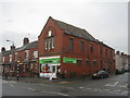
Co -op store on the corner of Ainslie Street and Settle Street, Barrow
Image: © Jonathan Thacker
Taken: 29 Oct 2010
0.09 miles
8
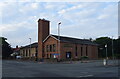
Abbey Road, Baptist Church, Barrow-in-Furness
Image: © JThomas
Taken: 2 Jul 2021
0.09 miles
9
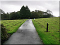
Path in Barrow Park
A path near the northern entrance to the park from Abbey Road.
Barrow Park is a 45-acre public park bound by Abbey Road, Park Drive, Greengate Street and Park Avenue. The Park was designed by Thomas Mawson in 1908 and was constructed in stages over the following two decades. The site was originally on the outskirts of Barrow but the park is now more or less central due to the rapid growth of the town northwards during the early 20th century. It is designated by Historic England as Grade II on the Register of Historic Parks and Gardens (https://historicengland.org.uk/listing/the-list/list-entry/1437665 List Entry Number: 1437665).
Image: © David Dixon
Taken: 26 Aug 2020
0.10 miles
10
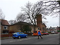
Baptist Church, Barrow-in-Furness: mid-February 2015
Image: © Basher Eyre
Taken: 18 Feb 2015
0.10 miles