
IMAGES TAKEN NEAR TO
Vespers Grove, BARROW-IN-FURNESS, LA14 4RX
Introduction
This page details the photographs taken nearby to Vespers Grove, LA14 4RX by members of the Geograph project.
The Geograph project started in 2005 with the aim of publishing, organising and preserving representative images for every square kilometre of Great Britain, Ireland and the Isle of Man.

There are currently over 7.5m images from over14,400 individuals and you can help contribute to the project by visiting https://www.geograph.org.uk
Image Map
Images are licensed for reuse under creativecommons.org/licenses/by-sa/2.0
Notes
- Clicking on the map will re-center to the selected point.
- The higher the marker number, the further away the image location is from the centre of the postcode.
Image Listing (13 Images Found)
Images are licensed for reuse under creativecommons.org/licenses/by-sa/2.0
Image
Details
Distance
1

Sheep Dalton Lane
On the outskirts of Barrow.
Image: © Michael Graham
Taken: Unknown
0.08 miles

3
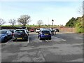
Abbey House Hotel car park
The car park of Abbey House Hotel with a classic example of inconsiderate parking.
Image: © Adrian Taylor
Taken: 25 Nov 2021
0.15 miles
4

Stone Trough
At the junction of Abbey Road and Breast Mill Beck Road.
Seems to have had a tough time was built in 1876 then re erected in 1910 and replaced in 2002
Image: © Michael Graham
Taken: Unknown
0.15 miles
5

Ordnance Survey Cut Mark
This OS cut mark can be found on the wall at the junction of Abbey Road & Abbey Approach. It marks a point 40.275m above mean sea level.
Image: © Adrian Dust
Taken: 4 Mar 2022
0.15 miles
6
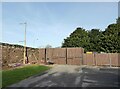
Abbey House Hotel car park
In the corner of the Abbey House Hotel car park storage containers are tidily concealed behind wooden panels and gates.
Image: © Adrian Taylor
Taken: 25 Nov 2021
0.15 miles
7

Gateway on Abbey Approach
The stone arch straddles Abbey Approach at its junction with Barrow Road. The arch dates from around 1873 and is grade II listed.
Link to the structure's page on the English Heritage website: http://list.english-heritage.org.uk/resultsingle.aspx?uid=1292595
Image: © Graham Robson
Taken: 3 Nov 2014
0.16 miles
8

Ordnance Survey Cut Mark
This OS cut mark can be found on the wall east side of Abbey Approach. It marks a point 24.240m above mean sea level.
Image: © Adrian Dust
Taken: 4 Mar 2022
0.23 miles
9

House near Furness Abbey
The nearest part of this house appears to be original but the porch and possibly the part farthest from the camera are recent additions.
Image: © Jonathan Thacker
Taken: 7 May 2011
0.24 miles
10

Path to Vale of Nightshade
The path leads down under the low railway bridge to the Vale of Nightshade
Image: © Raymond Knapman
Taken: 22 Sep 2021
0.24 miles