IMAGES TAKEN NEAR TO
Ramsden Dock Road, BARROW-IN-FURNESS, LA14 2TN
Introduction
This page details the photographs taken nearby to Ramsden Dock Road, LA14 2TN by members of the Geograph project.
The Geograph project started in 2005 with the aim of publishing, organising and preserving representative images for every square kilometre of Great Britain, Ireland and the Isle of Man.

There are currently over 7.5m images from over14,400 individuals and you can help contribute to the project by visiting https://www.geograph.org.uk
Image Map
Images are licensed for reuse under creativecommons.org/licenses/by-sa/2.0
Notes
- Clicking on the map will re-center to the selected point.
- The higher the marker number, the further away the image location is from the centre of the postcode.
Image Listing (52 Images Found)
Images are licensed for reuse under creativecommons.org/licenses/by-sa/2.0
Image
Details
Distance
2
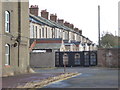
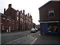
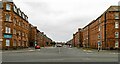
The back of James Watt Terrace, Barrow-in-Furness
The road extending off to the left out of sight is Siemen's Street. This is worker's housing on Barrow Island. A short distance to the right is the Walney Channel.
Image: © Chris Allen
Taken: 21 Sep 2018
0.06 miles
3
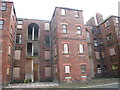
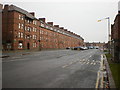
Tenement Blocks on Barrow Island
Seen better days!
Image: © Vicki Deritis
Taken: 13 Feb 2009
0.06 miles
5
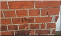
Ordnance Survey Cut Mark
This OS cut mark can be found on the Harbour Dock Offices. It marks a point 14.876m above mean sea level.
Image: © Adrian Dust
Taken: 15 Oct 2019
0.07 miles
7
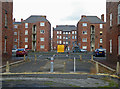
Egerton Court - Barrow-in-Furness
Tenement style blocks that I believe were 'company housing' related to the ship building business on Barrow Island.
Image: © Chris Allen
Taken: 21 Sep 2018
0.08 miles
8
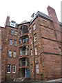
Tenement Block on Ship Street on Barrow Island
Image: © Vicki Deritis
Taken: 13 Feb 2009
0.08 miles
9
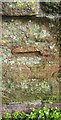
Ordnance Survey Cut Mark
This very worn OS cut mark can be found on the NE parapet of the old railway bridge. It marks a point 13.384m above mean sea level.
Image: © Adrian Dust
Taken: 15 Oct 2019
0.09 miles