IMAGES TAKEN NEAR TO
Parade Street, BARROW-IN-FURNESS, LA14 2NL
Introduction
This page details the photographs taken nearby to Parade Street, LA14 2NL by members of the Geograph project.
The Geograph project started in 2005 with the aim of publishing, organising and preserving representative images for every square kilometre of Great Britain, Ireland and the Isle of Man.

There are currently over 7.5m images from over14,400 individuals and you can help contribute to the project by visiting https://www.geograph.org.uk
Image Map
Images are licensed for reuse under creativecommons.org/licenses/by-sa/2.0
Notes
- Clicking on the map will re-center to the selected point.
- The higher the marker number, the further away the image location is from the centre of the postcode.
Image Listing (97 Images Found)
Images are licensed for reuse under creativecommons.org/licenses/by-sa/2.0
Image
Details
Distance
1

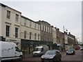
Barrow old fire station
Barrow old fire station, Abbey Road, Barrow in Furness, Cumbria
Image: © Kevin Hale
Taken: 30 Jul 2010
0.04 miles
2
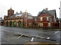
Former Fire Station, Barrow in Furness
The fire station which until 1996 served the people of Barrow in Furness. It was closed as the result of the building of a new station on Phoenix Road in the town. It has since been converted and put to new use.
Image: © Graham Robson
Taken: 9 Nov 2012
0.04 miles
3
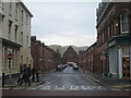
View down Parade Street, Barrow in Furness
The church at the end is now a tyre depot.
Image: © Jonathan Thacker
Taken: 29 Oct 2010
0.04 miles
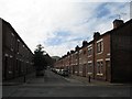
6
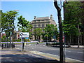
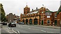
Ramsden Square
Formerly the town's major intersection where Abbey Road, the main road in and out, crosses Duke Street, the commercial hub. It has a strangely French feel about it.
Image: © Rosalind Mitchell
Taken: 8 Jun 2006
0.06 miles
7
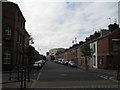
St. Vincent Street, Barrow-in-Furness
Image: © Gerald Massey
Taken: 22 Sep 2009
0.07 miles
8
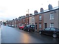
St Vincent Street, Barrow-in-Furness
A street of terraced houses close to the centre of Barrow.
Image: © Graham Robson
Taken: 3 Nov 2014
0.07 miles
9
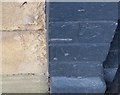
Ordnance Survey Cut Mark
This OS cut mark can be found on No85 Duke Street. It marks a point 9.677m above mean sea level.
Image: © Adrian Dust
Taken: 28 Mar 2018
0.07 miles