
IMAGES TAKEN NEAR TO
Dalton Road, BARROW-IN-FURNESS, LA14 1PN
Introduction
This page details the photographs taken nearby to Dalton Road, LA14 1PN by members of the Geograph project.
The Geograph project started in 2005 with the aim of publishing, organising and preserving representative images for every square kilometre of Great Britain, Ireland and the Isle of Man.

There are currently over 7.5m images from over14,400 individuals and you can help contribute to the project by visiting https://www.geograph.org.uk
Image Map
Images are licensed for reuse under creativecommons.org/licenses/by-sa/2.0
Notes
- Clicking on the map will re-center to the selected point.
- The higher the marker number, the further away the image location is from the centre of the postcode.
Image Listing (96 Images Found)
Images are licensed for reuse under creativecommons.org/licenses/by-sa/2.0
Image
Details
Distance
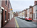
2
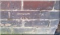
Ordnance Survey Cut Mark
This OS cut mark can be found on No52 Manchester Street. It marks a point 9.897m above mean sea level.
Image: © Adrian Dust
Taken: 28 Mar 2018
0.04 miles
3
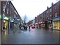
Dalton Road, Barrow-in-Furness
A part pedestrianised shopping street on the edge of Barrow town centre.
Image: © Graham Robson
Taken: 3 Nov 2014
0.05 miles
4

St Mark's Church
On the corner of Rawlinson Street and Buccleuch Street. A centre for the evangelical tendency in the Church of England.
Image: © Rosalind Mitchell
Taken: 5 Jul 2007
0.06 miles
5

Victoria Hall
Looking south from Rawlinson Street
Image: © Rosalind Mitchell
Taken: 5 Jul 2007
0.06 miles
6
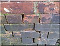
Ordnance Survey Cut Mark
This damaged OS cut mark can be found at the junction of High Street & Coulton Street. It marks a point 9.215m above mean sea level.
Image: © Adrian Dust
Taken: 28 Mar 2018
0.06 miles
7
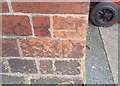
Ordnance Survey Cut Mark
This OS cut mark can be found on the SE face of Rossall House. It marks a point 10.360m above mean sea level.
Image: © Adrian Dust
Taken: 28 Mar 2018
0.07 miles
8
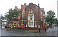
Rossall House, next to The Salvation Army building, Abbey Road
There is an OS benchmark Image on the front of the house at the corner (with Hartington Street) at its right hand corner.
Image: © Roger Templeman
Taken: 16 Aug 2019
0.07 miles
9
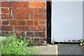
Benchmark on Rossall House, Abbey Road
Ordnance Survey cut mark benchmark levelled at 10.36m above Newlyn Datum
Image: © Roger Templeman
Taken: 16 Aug 2019
0.07 miles
10
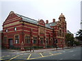
The Nan Tait Centre
Originally built as the Barrow-in-Furness Technical College
Image: © Alexander P Kapp
Taken: 31 Jul 2007
0.08 miles