
IMAGES TAKEN NEAR TO
Sutherland Street, BARROW-IN-FURNESS, LA14 1BN
Introduction
This page details the photographs taken nearby to Sutherland Street, LA14 1BN by members of the Geograph project.
The Geograph project started in 2005 with the aim of publishing, organising and preserving representative images for every square kilometre of Great Britain, Ireland and the Isle of Man.

There are currently over 7.5m images from over14,400 individuals and you can help contribute to the project by visiting https://www.geograph.org.uk
Image Map
Images are licensed for reuse under creativecommons.org/licenses/by-sa/2.0
Notes
- Clicking on the map will re-center to the selected point.
- The higher the marker number, the further away the image location is from the centre of the postcode.
Image Listing (40 Images Found)
Images are licensed for reuse under creativecommons.org/licenses/by-sa/2.0
Image
Details
Distance
1

Rawlinson Street
A busy road linking Abbey Road and the station area with the Salthouse Road area, avoiding the town centre. It has a 1950s feel about it, tawdry and lined with independent shops as well as terrace housing.
Image: © Rosalind Mitchell
Taken: 5 Jul 2007
0.13 miles

3

Ordnance Survey Cut Mark
This OS cut mark can be found on the NW parapet of the railway bridge. It marks a point 14.255m above mean sea level.
Image: © Adrian Dust
Taken: 28 Feb 2022
0.14 miles
4

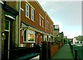
Presbyterian Church, Barrow
At the time the photograph it was waiting to be repaired or demolished because of serious fire damage
Image: © Alexander P Kapp
Taken: 17 Aug 2005
0.16 miles
6

Ordnance Survey Pivot
This OS pivot can be found on the window sill of No77 School Road. It marks a point 18.968m above mean sea level.
Image: © Adrian Dust
Taken: 28 Feb 2022
0.17 miles
7
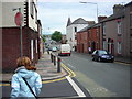
Greengate Street
A busy route from the south of the town centre to the suburb of Newbarns. From the junction with Allison Street, looking north of east towards the bridge over the railway line to Lancaster.
Image: © Rosalind Mitchell
Taken: 5 Jul 2007
0.18 miles
8

Ordnance Survey Cut Mark
This OS cut mark can be found on the north angle of the Health Studio on Greengate Street.
Image: © Adrian Dust
Taken: 28 Feb 2022
0.19 miles
9

The spirit of Barrow sculpture, Dalton Road, Barrow in Furness
The sculpture sits in the centre of the Dalton Road shopping area. It was created by Chris Kelly and unveiled in 2005 and depicts 4 Barrow workers and their respective areas of expertise within industry.
Image: © Graham Robson
Taken: 9 Nov 2012
0.19 miles
10

Crellin Street
Seen looking north-east from a point close to Barrow's main shopping street, Dalton Road. Intensively and industrial as Barrow may be green pastures and rolling hills are never far away.
Image: © Rosalind Mitchell
Taken: 5 Jul 2007
0.19 miles