
IMAGES TAKEN NEAR TO
The Piazza, LANCASTER, LA1 3FJ
Introduction
This page details the photographs taken nearby to The Piazza, LA1 3FJ by members of the Geograph project.
The Geograph project started in 2005 with the aim of publishing, organising and preserving representative images for every square kilometre of Great Britain, Ireland and the Isle of Man.

There are currently over 7.5m images from over14,400 individuals and you can help contribute to the project by visiting https://www.geograph.org.uk
Image Map
Images are licensed for reuse under creativecommons.org/licenses/by-sa/2.0
Notes
- Clicking on the map will re-center to the selected point.
- The higher the marker number, the further away the image location is from the centre of the postcode.
Image Listing (115 Images Found)
Images are licensed for reuse under creativecommons.org/licenses/by-sa/2.0
Image
Details
Distance
1
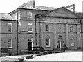
Lancaster Moor Hospital
The county lunatic asylum, on Lancaster Moor, established in 1816, is a spacious quadrangular structure of stone, with a handsome portico of the Doric order, and, with the gardens and grounds, occupies 50 acres of land; it was erected at an expense of £175,000, including the furniture. from A Topographical history of England 1848 (British History Online)
Architect: Thomas Standen
Image: © Eileen Cowen
Taken: 22 Apr 2008
0.02 miles
2

Former Chapel, Lancaster Moor Asylum
Now a housing development.
Image: © Peter Bond
Taken: 23 Apr 2011
0.02 miles
3

Lancaster Moor Asylum datestone 1816
In 1809 The Court of Annual Sessions, stated an intention ‘to erect a Lunatic Asylum, or House, for the reception of Lunatics or other Insane Persons’ in the County Palatine of Lancaster. Plans for the Asylum, to provide accommodation for 120 Lunatics were prepared by a local architect Thomas Standen. Construction began in 1812, and was completed in July 1816 when the Asylum opened.A large ‘Country House’ design was adopted, ‘with a handsome and stately home front, ornamented with pillars of the Doric order’ and was reported as the ‘most magnificent edifice, the Castle excluded that Lancaster had to boast’.
The County Asylum admitted patients from a large area extending from Furness to the Fylde Coast, and extensively inland.
Image: © Eileen Cowen
Taken: 22 Apr 2008
0.03 miles
4

Lancaster Moor Asylum - chapel
Added to the 1816 asylum in 1842. By this time Samuel Gaskell, surgeon, was superintendent and there were about 600 patients, all paupers.
Image: © Eileen Cowen
Taken: 22 Apr 2008
0.03 miles
5

Datestone over doorway into chapel, Lancaster Moor Asylum
Image: © Eileen Cowen
Taken: 22 Apr 2008
0.03 miles
6

OS Bench Mark
OS cut bench mark from the 19th century levelling, on a wall in the grounds of the former 'County Lunatic Asylum', now Standen Park. 214.0 feet above old datum. Badly eroded and hard to spot.
Image: © Phil Johnstone
Taken: 16 Aug 2021
0.05 miles
7
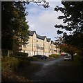
Fenham Carr Lane
Houses built in the grounds of the former Lancaster Moor Hospital.
Image: © Richard Webb
Taken: 18 Oct 2019
0.12 miles
8

Old Reservoir, Fenham Carr
The reservoir was formerly used to supply water to the hospital fire brigade serving the old 'County Mental' which was Lancaster Moor Hospitals former name. Latterly when the hospital was still operating the reservoir was used as a staff fishing club. The massive mental hospital is now closed. It is an interesting sign of the times to note that the 3 community units opened to replace the hospital in 2000 are now being closed themselves. This modern PFI scheme lasted only a fraction of time that the old asylum stood.
Image: © Michael Graham
Taken: 12 Mar 2013
0.13 miles
9

Williamson Park, Lancaster
Fenham Carr, the eastern side of the park, is less formal than the western side and generally quieter, probably because it has fewer access points and less dynamic views. This view is looking across to the tower of the old Lancaster Moor Hospital North Annexe. The building in the centre is the old St Michael's Church, which was built for the hospital in c.1866, and is now converted into flats (from Pevsner).
Image: © Ian Taylor
Taken: 30 Oct 2011
0.13 miles
10

OS Bench Mark
OS cut bench mark from the 20th century levelling, on wall between Williamson's Park and Fenham Carr. 100.40 m above datum. This replaces a 19th century BM at the edge of the track, presumably destroyed when the track was widened. On the 1931 25" OS map a BM is marked on the wall some 25 m SW, but it does not appear on the 1938 map.
Image: © Phil Johnstone
Taken: 9 Dec 2021
0.13 miles