
IMAGES TAKEN NEAR TO
Tarnbrook Road, LANCASTER, LA1 2QE
Introduction
This page details the photographs taken nearby to Tarnbrook Road, LA1 2QE by members of the Geograph project.
The Geograph project started in 2005 with the aim of publishing, organising and preserving representative images for every square kilometre of Great Britain, Ireland and the Isle of Man.

There are currently over 7.5m images from over14,400 individuals and you can help contribute to the project by visiting https://www.geograph.org.uk
Image Map
Images are licensed for reuse under creativecommons.org/licenses/by-sa/2.0
Notes
- Clicking on the map will re-center to the selected point.
- The higher the marker number, the further away the image location is from the centre of the postcode.
Image Listing (18 Images Found)
Images are licensed for reuse under creativecommons.org/licenses/by-sa/2.0
Image
Details
Distance


3
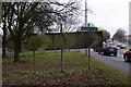
Morecambe Road at Scale Hall
The road signs could do with a clean. The chevrons are redundant when there is a stream of traffic, as now. The cycle track into Morecambe follows the route of the "Little" North Western Railway.
Image: © Ian Taylor
Taken: 23 Mar 2013
0.15 miles
4

Traffic on Morecambe Road
Traffic on a busy Morecambe Road on a wet Friday afternoon.
Image: © Graham Robson
Taken: 8 Nov 2013
0.15 miles
5

Footpath and cycle path to Morecambe
Looking along the shared footpath and cycle path towards Morecambe. The smear on the top left of the photo was caused by rain falling on the lens of my camera. The persistent rain perhaps meant the path was less busy than normal.
Image: © Graham Robson
Taken: 8 Nov 2013
0.16 miles
6

Cycle Path
Cycle Path near Salt Ayre in Lancaster.
Image: © Peter McDermott
Taken: 25 Mar 2016
0.17 miles
7
![Former Morecambe - Lancaster railway line [5]](https://s3.geograph.org.uk/geophotos/03/71/51/3715167_84749ab3_120x120.jpg)
Former Morecambe - Lancaster railway line [5]
Now the Greenway, part of the Lancashire Coastal Way.
Image: © Christine Johnstone
Taken: 10 Oct 2013
0.18 miles
8

Scale Hall, Spar
Convenience store at the corner of Torrisholme and Scale Hall Roads.
Image: © Mike Faherty
Taken: 11 May 2012
0.19 miles
9

Lancaster Cricket Club
The pitch, grounds and clubhouse at Lancaster's Cricket club, on the bank of the River Lune.
Image: © Roger May
Taken: 10 Aug 2005
0.19 miles
10

Junction of Scale Hall Lane and Torrisholme Road
Image: © Robert Eva
Taken: 12 Feb 2020
0.20 miles