
IMAGES TAKEN NEAR TO
Tan Hill Drive, LANCASTER, LA1 2JB
Introduction
This page details the photographs taken nearby to Tan Hill Drive, LA1 2JB by members of the Geograph project.
The Geograph project started in 2005 with the aim of publishing, organising and preserving representative images for every square kilometre of Great Britain, Ireland and the Isle of Man.

There are currently over 7.5m images from over14,400 individuals and you can help contribute to the project by visiting https://www.geograph.org.uk
Image Map
Images are licensed for reuse under creativecommons.org/licenses/by-sa/2.0
Notes
- Clicking on the map will re-center to the selected point.
- The higher the marker number, the further away the image location is from the centre of the postcode.
Image Listing (31 Images Found)
Images are licensed for reuse under creativecommons.org/licenses/by-sa/2.0
Image
Details
Distance
2

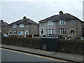
Stone posts at top of steps, Skerton
These look quite expensive. I should think that, having taken over this part of Skerton in 1900, Lancaster wanted to make a 'prestige' promenade along the bank of the River Lune, with access from the road by steps.
Image: © Humphrey Bolton
Taken: 19 Dec 2007
0.14 miles
3

Cemetery Gates, Skerton
The cemetery did not exist in 1890, and was probably made after this part of Skerton was added to Lancaster in 1900. Beyond the gates, most of the cemetery is in SD4763.
Image: © Humphrey Bolton
Taken: 19 Dec 2007
0.14 miles
4

Cemetery Chapel, west end, Skerton
A detail of the chapel, showing the tapering buttresses and the rather complicated west window. There are small holes in the glass, and the barge-boards need painting.
Image: © Humphrey Bolton
Taken: 19 Dec 2007
0.14 miles
5

Cemetery Chapel and Lodge, Skerton
Quite a large chapel, with a belfry and spirelet.
Image: © Humphrey Bolton
Taken: 19 Dec 2007
0.14 miles
6
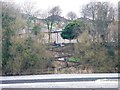
Zigzag path down Lune Bank, off Halton Road
With the River Lune's Skerton Weir in the foreground.
Image: © Christine Johnstone
Taken: 9 Mar 2015
0.15 miles
7

Fish Ladder
The first weir the tidal water meets on its way up the River Lune, Twelve miles or more from the entrance to the channel in Morecambe Bay.
Image: © Arnold Price
Taken: 2 Nov 2006
0.18 miles
8

Looking 'south' from Beaumont Turnpike Bridge
Image: © David Long
Taken: 3 Oct 2008
0.19 miles
9

Lancaster Canal in Beaumont, Lancaster
This stretch of the canal is between bridges 109 and 110.
Image: © Mat Fascione
Taken: 18 Sep 2018
0.21 miles
10
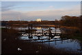
Skerton Weir, River Lune
Looking upstream, the weir is the normal tidal limit.
The footbridges in the foreground presumably provide access to valves or sluices.
An arch of the Lune Aqueduct can be seen in the distance on the left. (See Image)
Image: © Ian Taylor
Taken: 28 Jan 2012
0.21 miles