
IMAGES TAKEN NEAR TO
Broadway, LANCASTER, LA1 2BX
Introduction
This page details the photographs taken nearby to Broadway, LA1 2BX by members of the Geograph project.
The Geograph project started in 2005 with the aim of publishing, organising and preserving representative images for every square kilometre of Great Britain, Ireland and the Isle of Man.

There are currently over 7.5m images from over14,400 individuals and you can help contribute to the project by visiting https://www.geograph.org.uk
Image Map
Images are licensed for reuse under creativecommons.org/licenses/by-sa/2.0
Notes
- Clicking on the map will re-center to the selected point.
- The higher the marker number, the further away the image location is from the centre of the postcode.
Image Listing (11 Images Found)
Images are licensed for reuse under creativecommons.org/licenses/by-sa/2.0
Image
Details
Distance
1
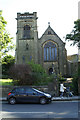
St Joseph's RC Church, Slyne Road/ Owen Road
Image: © David Long
Taken: 3 Oct 2008
0.11 miles
3
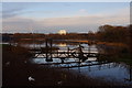
Skerton Weir, River Lune
Looking upstream, the weir is the normal tidal limit.
The footbridges in the foreground presumably provide access to valves or sluices.
An arch of the Lune Aqueduct can be seen in the distance on the left. (See Image)
Image: © Ian Taylor
Taken: 28 Jan 2012
0.16 miles
4

Skerton Weir, River Lune
Looking downstream over the weir. The weir is A-shaped. This means that floating debris will often get trapped at the side of the river, as has happened to a tree here.
Image: © Ian Taylor
Taken: 28 Jan 2012
0.16 miles
5
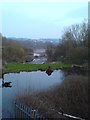
River Lune from Halton Road at low tide
Image: © Schlosser67
Taken: 22 Mar 2012
0.17 miles
6
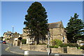
Ancient monkey puzzle tree
In the grounds of former Health Authority buildings, which had previously been a Police Station. Now For Sale.
Image: © David Long
Taken: 3 Oct 2008
0.17 miles
7
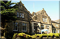
Former lives
This fine building, lately Health Authority offices, was once a major Police Station beside the A6. It is now For Sale.
Image: © David Long
Taken: 3 Oct 2008
0.18 miles
8

River Lune
Beyond the frozen section above the weir is a large wooded island.
Image: © Michael Graham
Taken: 1 Jan 2009
0.21 miles
9
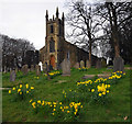
St Luke's Church, Skerton
Grade II Listed Building http://list.historicengland.org.uk/resultsingle.aspx?uid=1195002
Image: © Ian Taylor
Taken: 2 Apr 2015
0.22 miles
10
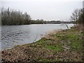
The River Lune at Cow Shard
Looking upstream, near the top of the tide.
Image: © Christine Johnstone
Taken: 9 Mar 2015
0.22 miles