
IMAGES TAKEN NEAR TO
Yealand Drive, ULVERSTON, LA12 9JB
Introduction
This page details the photographs taken nearby to Yealand Drive, LA12 9JB by members of the Geograph project.
The Geograph project started in 2005 with the aim of publishing, organising and preserving representative images for every square kilometre of Great Britain, Ireland and the Isle of Man.

There are currently over 7.5m images from over14,400 individuals and you can help contribute to the project by visiting https://www.geograph.org.uk
Image Map
Images are licensed for reuse under creativecommons.org/licenses/by-sa/2.0
Notes
- Clicking on the map will re-center to the selected point.
- The higher the marker number, the further away the image location is from the centre of the postcode.
Image Listing (21 Images Found)
Images are licensed for reuse under creativecommons.org/licenses/by-sa/2.0
Image
Details
Distance


3

Mountbarrow Road at its junction with Central Drive in Ulverston
Looking south-westward.
Image: © Peter Wood
Taken: 31 Oct 2018
0.17 miles
4

Oakwood Drive
Housing area on the south side of Ulverston.
Image: © Mary and Angus Hogg
Taken: 22 Feb 2018
0.18 miles
5

Benchmark, Ulverston Victoria High School Wall
Detail of an Ordnance Survey cut benchmark on the west face of a wall pillar facing onto Springfield Road. The benchmark marks a height of 34.9505m above Ordnance Datum Newlyn last levelled and verified in 1968 (location photograph Image).
Image: © Adrian Taylor
Taken: 8 Sep 2021
0.19 miles
6
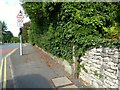
Springfield Road, Ulverston
Springfield Road on the approach to Ulverston Victoria High School.
Beyond the limestone rubble wall and the bottom of a telephone distribution pole is a dressed stone wall pillar, marking the Ulverston Victoria High School boundary and almost completely overgrown with ivy. On the other side of this is a low stone wall which supported cast iron railings, removed during the Second World War as the metal was needed for the war effort.
There is an Ordnance Survey cut benchmark on the wall pillar (photograph Image).
Image: © Adrian Taylor
Taken: 8 Sep 2021
0.19 miles
7
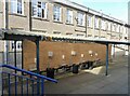
Temporary Washing Facility
A cycle shed in the yard between the main and ‘S’ blocks of Ulverston Victoria High School has been utilised to create a temporary outdoor washing facility. This is in response to the COVID-19 virus; students are encouraged to wash their hands more frequently to avoid spreading infection.
The day was hot and classroom windows have been opened wide for additional ventilation.
Image: © Adrian Taylor
Taken: 8 Sep 2021
0.20 miles
8

Back of the school
At the rear of the south wing of the main Ulverston Victoria High School building, a service door gives access to a basement area.
The east end of the ‘S Block’ is in the left background.
Image: © Adrian Taylor
Taken: 8 Sep 2021
0.20 miles

10

Central Drive at Croftlands in Ulverston
Looking south-eastward.
Image: © Peter Wood
Taken: 31 Oct 2018
0.21 miles