
IMAGES TAKEN NEAR TO
Cross Lane, ULVERSTON, LA12 9BW
Introduction
This page details the photographs taken nearby to Cross Lane, LA12 9BW by members of the Geograph project.
The Geograph project started in 2005 with the aim of publishing, organising and preserving representative images for every square kilometre of Great Britain, Ireland and the Isle of Man.

There are currently over 7.5m images from over14,400 individuals and you can help contribute to the project by visiting https://www.geograph.org.uk
Image Map
Images are licensed for reuse under creativecommons.org/licenses/by-sa/2.0
Notes
- Clicking on the map will re-center to the selected point.
- The higher the marker number, the further away the image location is from the centre of the postcode.
Image Listing (11 Images Found)
Images are licensed for reuse under creativecommons.org/licenses/by-sa/2.0
Image
Details
Distance
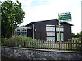
2
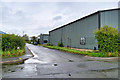
Cross Lane, North Lonsdale Industrial Estate
Image: © David Dixon
Taken: 25 Aug 2020
0.03 miles
3

Housing on Cross Lane
Modern houses and apartments on Cross Lane, on the east side of Ulverston.
Image: © Mary and Angus Hogg
Taken: 22 Feb 2018
0.09 miles
4

Ordnance Survey Flush Bracket S0994
This can be found on the roadside wall of Field Cottage at Outcast, Ulverston. The benchmark height is recorded as being 6.504 metres above sea level.
For more detail see : https://www.bench-marks.org.uk/bm12453
Image: © Peter Wood
Taken: 31 Oct 2018
0.11 miles
5
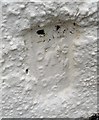
Ordnance Survey Flush Bracket (S0994)
This OS Flush Bracket can be found on No13 Outcast Cottages. It marks a point 6.504m above mean sea level.
Image: © Adrian Dust
Taken: 10 Oct 2019
0.11 miles
6
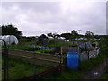
Allotments, Outcast.
In Ulverston, flying the flag.
Image: © Michael Graham
Taken: Unknown
0.12 miles
7
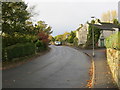
Outcast in Ulverston
Looking north-westward. Nothing sinister in the title; it's just the name of the road.
Image: © Peter Wood
Taken: 31 Oct 2018
0.16 miles
8
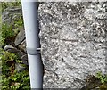
Ordnance Survey Cut Mark
This OS cut mark can be found on the house at the junction of Rope Walk. It marks a point 6.678m above mean sea level.
Image: © Adrian Dust
Taken: 10 Oct 2019
0.16 miles
9
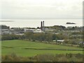
GSK, South Ulverston
GSK (Glaxo Smith Kline) pharmaceutical factory occupies the site of a former ironworks.
Image: © Stephen Craven
Taken: 15 Oct 2020
0.22 miles
10
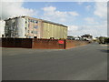
The Glaxo-Smithcline plant on the outskirts of Ulverston
Image: © Phil Catterall
Taken: 27 Jul 2006
0.23 miles