
IMAGES TAKEN NEAR TO
Blawith, ULVERSTON, LA12 8EL
Introduction
This page details the photographs taken nearby to LA12 8EL by members of the Geograph project.
The Geograph project started in 2005 with the aim of publishing, organising and preserving representative images for every square kilometre of Great Britain, Ireland and the Isle of Man.

There are currently over 7.5m images from over14,400 individuals and you can help contribute to the project by visiting https://www.geograph.org.uk
Image Map
Images are licensed for reuse under creativecommons.org/licenses/by-sa/2.0
Notes
- Clicking on the map will re-center to the selected point.
- The higher the marker number, the further away the image location is from the centre of the postcode.
Image Listing (28 Images Found)
Images are licensed for reuse under creativecommons.org/licenses/by-sa/2.0
Image
Details
Distance

2

On the slopes of Tottlebank Height.
Looking back in the direction of Cockenskell and Greenholme Farms. An old rhyme attributed to Stalker the farmer at Greenholme by Heaton Cooper goes:
'Blawith poor people An auld church and a new steeple, As poor as hell They had to sell A bit of fell To buy a bell. Blawith poor people' Relates to a time when some Common Land was sold to pay to the local Bishop.
Image: © Michael Graham
Taken: 21 Jan 2007
0.12 miles
3

Path near Appletree Holme
This path on Blawith Common near Appletree Holme is the route of The Cumbria Way (next photograph Image).
Image: © Adrian Taylor
Taken: 7 Mar 2023
0.13 miles

5
The Cumbria Way near Cockenskell
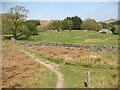
The Cumbria Way follows a well-worn path from Blawith Common towards Cockenskell and joins the bridleway from Appletree Holme to Woodland. Northbound walkers on The Cumbria Way keep left here (next photograph Image).
Image: © Adrian Taylor
Taken: 21 Apr 2019
0.14 miles
6

The Cumbria Way near Cockenskell
The Cumbria Way follows a well-worn path on Blawith Common towards Cockenskell (next photograph Image).
Image: © Adrian Taylor
Taken: 21 Apr 2019
0.15 miles
7

Footpath near Appletree Holme
This path through bracken near Appletree Holme is the public footpath from Tottlebank Farm to Cockenskell; it is also The Cumbria Way long distance path (next photograph Image).
Cockenskell Farm House is in the distance.
Image: © Adrian Taylor
Taken: 7 Mar 2023
0.15 miles
8

Gate on The Cumbria Way near Cockenskell
The Cumbria Way long distance path leaves Blawith Common and the bridleway from Appletree Holme to Woodland through a gate near Cockenskell, to join the public footpath to Beacon Tarn (next photograph Image).
Image: © Adrian Taylor
Taken: 21 Apr 2019
0.16 miles
9

The Cumbria Way near Cockenskell
The Cumbria Way, a 74 mile long distance path from Ulverston to Carlisle follows a public footpath through sheep pasture near Cockenskell (next photograph Image).
Image: © Adrian Taylor
Taken: 21 Apr 2019
0.16 miles
10
Paths near Appletree Holme
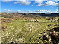
At this junction of paths on Blawith Common northbound walkers following The Cumbria Way keep left (next photograph Image).
Image: © Adrian Taylor
Taken: 7 Mar 2023
0.16 miles