IMAGES TAKEN NEAR TO
Water Yeat, ULVERSTON, LA12 8DW
Introduction
This page details the photographs taken nearby to LA12 8DW by members of the Geograph project.
The Geograph project started in 2005 with the aim of publishing, organising and preserving representative images for every square kilometre of Great Britain, Ireland and the Isle of Man.

There are currently over 7.5m images from over14,400 individuals and you can help contribute to the project by visiting https://www.geograph.org.uk
Image Map
Images are licensed for reuse under creativecommons.org/licenses/by-sa/2.0
Notes
- Clicking on the map will re-center to the selected point.
- The higher the marker number, the further away the image location is from the centre of the postcode.
Image Listing (16 Images Found)
Images are licensed for reuse under creativecommons.org/licenses/by-sa/2.0
Image
Details
Distance
2

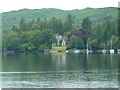
Across the hillside to the lake and beyond
Image: © David Brown
Taken: 2 Apr 2009
0.08 miles
3

Track into disused quarry near Toad Rock
Image: © Alexander P Kapp
Taken: 19 Apr 2011
0.13 miles

5

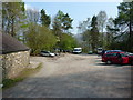
Brown Howe car park
A pretty little spot by Coniston Water. The picture appears grainy because it was pouring down and I was getting some shelter from a tree. I was heading from Barrow in Furness back to Keswick and decided to go via Coniston. Apart from the intermittent rain it was a pleasant and scenic run.
Image: © Chris Allen
Taken: 21 Sep 2018
0.16 miles


9

Put-in on Coniston Water for the Crake
The River Crake is a pleasant grade 2-3 trip, ideal for beginners, and being fed from Coniston Water, holds its level fairly well for a few days after rain. The put-in is from the car park at Brown Howe via this beach with a splendid view up Coniston Water, and with about a mile of paddling on the flat to reach the start of the river. This can be quite challenging if it's windy, however, especially from the north ! Parking here used to be free, but now the National Park impose a charge, and typically close the toilets all winter, so most paddlers will choose to drop off boats and park elsewhere at the side of the road - not really what they hoped to achieve, but utterly unsurprising, and it does at least ensure that the car park usually has plenty of space.
Image: © Andy Waddington
Taken: 18 Mar 2012
0.19 miles