
IMAGES TAKEN NEAR TO
Finsthwaite, ULVERSTON, LA12 8BN
Introduction
This page details the photographs taken nearby to LA12 8BN by members of the Geograph project.
The Geograph project started in 2005 with the aim of publishing, organising and preserving representative images for every square kilometre of Great Britain, Ireland and the Isle of Man.

There are currently over 7.5m images from over14,400 individuals and you can help contribute to the project by visiting https://www.geograph.org.uk
Image Map
Images are licensed for reuse under creativecommons.org/licenses/by-sa/2.0
Notes
- Clicking on the map will re-center to the selected point.
- The higher the marker number, the further away the image location is from the centre of the postcode.
Image Listing (15 Images Found)
Images are licensed for reuse under creativecommons.org/licenses/by-sa/2.0
Image
Details
Distance
2

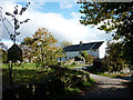
Towards Cobby House
Looking towards Cobby House from the road between Backbarrow and Finsthwaite.
Image: © DS Pugh
Taken: 16 Jul 2026
0.02 miles
3

Letterbox at Sinder Hill
A letterbox built into the wall along the road to Finsthwaite.
Image: © DS Pugh
Taken: 16 Jul 2026
0.04 miles
4
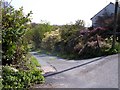
Public footpath signpost at Townend
Image: © Raymond Knapman
Taken: 20 Apr 2011
0.04 miles
5

Cottages at Sinder Hill
The road heads towards Finsthwaite.
Image: © DS Pugh
Taken: 16 Jul 2026
0.05 miles
6

Passing Finsyke Cottage
The road from Finsthwaite heading towards Town End.
Image: © DS Pugh
Taken: 16 Jul 2026
0.06 miles
7

Road near Finsyke Cottage
The road heads towards Finsthwaite.
Image: © DS Pugh
Taken: 16 Jul 2026
0.07 miles
8

Woods near Finsyke Cottage
Woodland along the road towards Finsthwaite.
Image: © DS Pugh
Taken: 16 Jul 2026
0.07 miles
9

Road passing Charley Cragg Farm
The road heading towards Finsthwaite.
Image: © DS Pugh
Taken: 16 Jul 2026
0.11 miles
10
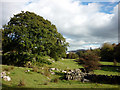
The path to Tom Crag?
Although signed at this end where it leaves the road, there was no trace of its other end at Tom Crag (Town End) visible beyond the trees. Indeed, the map seems to suggest that it does not quite connect with the footpath there. Or are the local residents being naughty?
Image: © Karl and Ali
Taken: 16 Oct 2010
0.15 miles