
IMAGES TAKEN NEAR TO
Levensgarth, ULVERSTON, LA12 8AG
Introduction
This page details the photographs taken nearby to Levensgarth, LA12 8AG by members of the Geograph project.
The Geograph project started in 2005 with the aim of publishing, organising and preserving representative images for every square kilometre of Great Britain, Ireland and the Isle of Man.

There are currently over 7.5m images from over14,400 individuals and you can help contribute to the project by visiting https://www.geograph.org.uk
Image Map
Images are licensed for reuse under creativecommons.org/licenses/by-sa/2.0
Notes
- Clicking on the map will re-center to the selected point.
- The higher the marker number, the further away the image location is from the centre of the postcode.
Image Listing (70 Images Found)
Images are licensed for reuse under creativecommons.org/licenses/by-sa/2.0
Image
Details
Distance
1
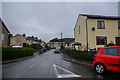
Haverthwaite : Levensgarth
Looking along Levensgarth off Levis Garth.
Image: © Lewis Clarke
Taken: 24 Sep 2019
0.03 miles
2

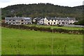
Cottages over the field
A tight cluster of houses separate from the main village. Could have been built for the explosives factory workers?
Image: © Peter Turner
Taken: 8 Feb 2013
0.04 miles
3

Haverthwaite : Oakmoss
A building on Levis Garth.
Image: © Lewis Clarke
Taken: 24 Sep 2019
0.05 miles
5
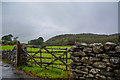
Haverthwaite : Grassy Field & Gate
Looking off the road and into the field.
Image: © Lewis Clarke
Taken: 24 Sep 2019
0.05 miles
6

Cottages along the road from Haverthwaite Station
These cottages look quite run down, standing beside the road between Haverthwaite railway station and the B5278.
Image: © DS Pugh
Taken: 16 Jul 2026
0.06 miles
8

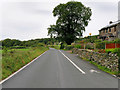
Road approaching the B5278
This road runs between the A590 near Haverthwaite station and the B5278.
Image: © DS Pugh
Taken: 16 Jul 2026
0.10 miles
9
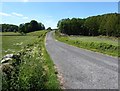
Old A590 road between the Angler's Arms and Creep Hill
A section of the former A590 road, rendered redundant by road improvements but still a public right of way
Image: © Adrian Taylor
Taken: 1 Jun 2020
0.11 miles
10

Footpath along side River Leven at Low Wood Bridge
Image: © Alexander P Kapp
Taken: 18 Apr 2011
0.12 miles