
IMAGES TAKEN NEAR TO
Fallowfield Avenue, ULVERSTON, LA12 7XD
Introduction
This page details the photographs taken nearby to Fallowfield Avenue, LA12 7XD by members of the Geograph project.
The Geograph project started in 2005 with the aim of publishing, organising and preserving representative images for every square kilometre of Great Britain, Ireland and the Isle of Man.

There are currently over 7.5m images from over14,400 individuals and you can help contribute to the project by visiting https://www.geograph.org.uk
Image Map
Images are licensed for reuse under creativecommons.org/licenses/by-sa/2.0
Notes
- Clicking on the map will re-center to the selected point.
- The higher the marker number, the further away the image location is from the centre of the postcode.
Image Listing (278 Images Found)
Images are licensed for reuse under creativecommons.org/licenses/by-sa/2.0
Image
Details
Distance


3

War memorial, Town Square at Ulverston
Image: © Gerald Massey
Taken: 22 Sep 2009
0.05 miles
4

Ordnance Survey 1GL Bolt
This OS Bolt can be found on the north face of the Old Church. It marks a point 30.577m above mean sea level.
Image: © Adrian Dust
Taken: 11 Nov 2016
0.06 miles
5
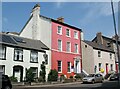
Sefton House, Queen Street
A guest house, coffee house and art gallery.
Image: © Adrian Taylor
Taken: 10 Jun 2018
0.06 miles
6

Tollhouse by Daltongate, Ulverston
Tollhouse in the parish of Ulverston (South Lakeland District), garden of No. 45, Daltongate.
Grade II listed.
List Entry Number: 1374990 https://historicengland.org.uk/listing/the-list/list-entry/1374990
To be surveyed
Milestone Society National ID: CB.ULV
Image: © Milestone Society
Taken: Unknown
0.07 miles
7
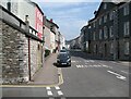
Queen Street, Ulverston
Formerly the A590 road, this is the walking route from Ulverston Station to the start of The Cumbria Way long distance footpath (next photograph Image).
The face of the building on the left is constructed from dressed limestone blocks; the side is mainly built from silurian slate rubble, both types of rock are found locally.
Image: © Adrian Taylor
Taken: 10 Jun 2018
0.07 miles
8

Ordnance Survey Cut Mark
This OS cut mark can be found on No36 Dalton Gate. It marks a point 39.303m above mean sea level.
Image: © Adrian Dust
Taken: 17 Oct 2019
0.07 miles
9
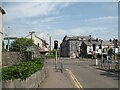
Prince's Street, Ulverston
The junction of Prince's Street and County Road.
This is the walking route from Ulverston Station to the start of The Cumbria Way long distance footpath (next photograph Image).
Image: © Adrian Taylor
Taken: 10 Jun 2018
0.07 miles
