
IMAGES TAKEN NEAR TO
Tebay Lane, ULVERSTON, LA12 7SG
Introduction
This page details the photographs taken nearby to Tebay Lane, LA12 7SG by members of the Geograph project.
The Geograph project started in 2005 with the aim of publishing, organising and preserving representative images for every square kilometre of Great Britain, Ireland and the Isle of Man.

There are currently over 7.5m images from over14,400 individuals and you can help contribute to the project by visiting https://www.geograph.org.uk
Image Map
Images are licensed for reuse under creativecommons.org/licenses/by-sa/2.0
Notes
- Clicking on the map will re-center to the selected point.
- The higher the marker number, the further away the image location is from the centre of the postcode.
Image Listing (67 Images Found)
Images are licensed for reuse under creativecommons.org/licenses/by-sa/2.0
Image
Details
Distance
1
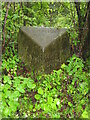
Old Milestone by A590, Causeway End
The Milestone is located beneath Hoad Hill on the East side of the road. Parish of Ulverston (South Lakeland District). Carved stone post, Lancs County Council stone triangle design, erected by the County Council in the 19th/20th Century.
Inscription reads:-
TO / ULVERSTON 1 MILE / BARROW 9¼ : : TO / GRANGE 14¾ MLS / KENDAL 25 / LANCASTER 36 : : ULVERSTON
Milestone Society National ID: LA_LABA36
Image: © Mike Rayner
Taken: 1 May 2022
0.02 miles
2
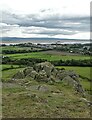
View from the slopes of Hoad Hill
To Cartmel Sands and Chapel Island
Image: © Neil Theasby
Taken: 19 Sep 2022
0.07 miles
3
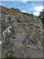
The 'Devil's Chair'
Carved into a crag below Hoad the Monument, it’s origin is unknown. It’s a local dare to climb up the rock face after dark and sit in the chair. There is plenty of activity around — graffiti, bolts to attach climbing ropes. It’s easy to cheat though by scrambling down to it.
Image: © Mick Garratt
Taken: 5 Sep 2022
0.08 miles
4

Hoad Hill and monument
Viewed from the railway.
Sir John Barrow Monument (colloquially known as Hoad) is a 30 m tower at the top of the 133 m Hoad Hill, near Ulverston. It commemorates Sir John Barrow (1764-1848), who was born in Ulverston. It was built in 1850 at a cost of £1250, the cost being met mainly by public subscription.
Sir John Barrow was a founding member of the Royal Geographical Society. He travelled to China and South Africa as a diplomat and held the post of Second Secretary to the Admiralty from 1804 until 1845.
Image: © Russel Wills
Taken: 26 Sep 2025
0.11 miles
6
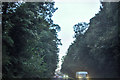
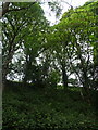
Ulverston : A590
Looking along the A590.
Image: © Lewis Clarke
Taken: 24 Sep 2019
0.13 miles
7
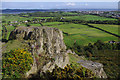
Outcrop on Hoad Hill
Outcrop on the south side of Hoad Hill, which looks like it may have been partly quarried.
View towards the Leven estuary, with the railway viaduct (SD3278) on the left and Glaxo works (SD3077) on the right.
The grazing land at the bottom of the hill looks rather soggy.
Image: © Ian Taylor
Taken: 12 Sep 2010
0.14 miles
9
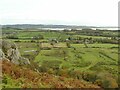
Fields below Hoad Hill
With a view out towards the Leven estuary.
Image: © Stephen Craven
Taken: 15 Oct 2020
0.14 miles
10
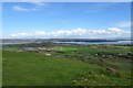
Top of Hoad Hill
Looking across Hoad Hill and towards the Leven Viaduct.
Image: © DS Pugh
Taken: 29 Mar 2024
0.16 miles