
IMAGES TAKEN NEAR TO
Hazelcroft Gardens, ULVERSTON, LA12 7AN
Introduction
This page details the photographs taken nearby to Hazelcroft Gardens, LA12 7AN by members of the Geograph project.
The Geograph project started in 2005 with the aim of publishing, organising and preserving representative images for every square kilometre of Great Britain, Ireland and the Isle of Man.

There are currently over 7.5m images from over14,400 individuals and you can help contribute to the project by visiting https://www.geograph.org.uk
Image Map
Images are licensed for reuse under creativecommons.org/licenses/by-sa/2.0
Notes
- Clicking on the map will re-center to the selected point.
- The higher the marker number, the further away the image location is from the centre of the postcode.
Image Listing (241 Images Found)
Images are licensed for reuse under creativecommons.org/licenses/by-sa/2.0
Image
Details
Distance
1

Ordnance Survey 1GL Bolt
This OS Bolt can be found on the north face of the Old Church. It marks a point 30.577m above mean sea level.
Image: © Adrian Dust
Taken: 11 Nov 2016
0.04 miles
2

Ordnance Survey Cut Mark
This OS cut mark can be found on the gatepost of Nos18 & 20 Princes Street. It marks a point 27.979m above mean sea level.
Image: © Adrian Dust
Taken: 17 Oct 2019
0.04 miles

4
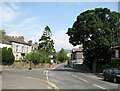
Prince's Street junction with Lightburn Road
This was once a busy junction, Lightburn Road on the left was the main A590 from Barrow-in-Furness which continued straight ahead towards the town centre before County Road was built providing a more direct route.
This is the walking route from Ulverston Station to the start of The Cumbria Way long distance footpath (next photograph Image).
Image: © Adrian Taylor
Taken: 10 Jun 2018
0.05 miles
5
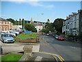
Prince's Street, Ulverston
View down the hill towards the junction with Lightburn Road. The spire of the former Holy Trinity Church, now converted into apartments is visible above the rooftops.
This is the walking route from Ulverston Station to the start of The Cumbria Way long distance footpath (next photograph Image).
The building to the left (photograph Image), now a car showroom, is the original Ulverston railway station.
Image: © Adrian Taylor
Taken: 14 Sep 2016
0.06 miles
6

Elizabeth II postbox on Lightburn Road, Ulverston
Postbox No. LA12 12.
Image: © JThomas
Taken: 3 Jul 2021
0.06 miles
7

Facing New Church Road from Lightburn Trading Estate Entrance
Image: © Darrin Antrobus
Taken: 18 Feb 2015
0.06 miles

9
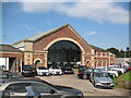
Old Station, Ulverston
This distinctive and imposing Grade II listed sandstone building was the original Furness Railway passenger station for Ulverston.
Although it was a terminus there was a confident expectation that the line would be extended eastwards to link up with the Lancaster and Carlisle Railway in due course. The large segmental arch was designed to allow for a continuation of the railway, thereby facilitating the creation of a through station with minimal disruption to the structure.
When the railway was extended the Ulverstone and Lancaster Railway built a new station at a lower level to the south of the original, thus minimising a need for expensive earthworks. The original station was relegated to the role of a goods shed and is now used as a car showroom.
Image: © Adrian Taylor
Taken: 14 Sep 2016
0.08 miles
10

Ulverston 1st railway station (site), Cumbria
Opened in 1854 by the Furness Railway as the terminus of its line from Barrow, this railway station closed to passengers after just three years when the current through station (immediately to the left, just out of view) was opened in 1857.
It continued for many more years as a goods station, and there are still sidings to the rear of it. It was a car showroom when this image was taken.
Image: © Nigel Thompson
Taken: 13 Jul 2013
0.08 miles