
IMAGES TAKEN NEAR TO
Moor Road, ULVERSTON, LA12 0UT
Introduction
This page details the photographs taken nearby to Moor Road, LA12 0UT by members of the Geograph project.
The Geograph project started in 2005 with the aim of publishing, organising and preserving representative images for every square kilometre of Great Britain, Ireland and the Isle of Man.

There are currently over 7.5m images from over14,400 individuals and you can help contribute to the project by visiting https://www.geograph.org.uk
Image Map
Images are licensed for reuse under creativecommons.org/licenses/by-sa/2.0
Notes
- Clicking on the map will re-center to the selected point.
- The higher the marker number, the further away the image location is from the centre of the postcode.
Image Listing (2 Images Found)
Images are licensed for reuse under creativecommons.org/licenses/by-sa/2.0
Image
Details
Distance
1
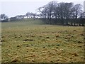
Rough grazing, Marton
A few sheep graze on this rough and rank grass.
Image: © Maigheach-gheal
Taken: 25 Mar 2010
0.14 miles
2
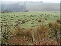
Grazing land and molehills near Marton
The grazing land has been infested by moles.
Moles live in loose, easily diggable soil throughout Britain, from sea level to about 3000ft, but there are no moles in Ireland. They do not colonise poor mountain soil or acid, sandy soil because these contain few earthworms.
Moles belong to the order of mammals called insectivores, and are related to hedgehogs.
Molehills spoil lawns and sports grounds and reduce the value of pasture. They may also damage blades of cutting machines. In addition, moles rob the soil of earthworms. Farmers and gardeners are therefore their chief enemies. Other enemies include owls, foxes, dogs and cats.
The mole's name is possibly a shortened form of 'mouldiwarp', a names still used in northern England, which is derived from Old English 'molde', meaning earth and 'werpen', meaning to throw.
Image: © Maigheach-gheal
Taken: 25 Mar 2010
0.22 miles