
IMAGES TAKEN NEAR TO
Lindal, ULVERSTON, LA12 0NB
Introduction
This page details the photographs taken nearby to LA12 0NB by members of the Geograph project.
The Geograph project started in 2005 with the aim of publishing, organising and preserving representative images for every square kilometre of Great Britain, Ireland and the Isle of Man.

There are currently over 7.5m images from over14,400 individuals and you can help contribute to the project by visiting https://www.geograph.org.uk
Image Map
Images are licensed for reuse under creativecommons.org/licenses/by-sa/2.0
Notes
- Clicking on the map will re-center to the selected point.
- The higher the marker number, the further away the image location is from the centre of the postcode.
Image Listing (7 Images Found)
Images are licensed for reuse under creativecommons.org/licenses/by-sa/2.0
Image
Details
Distance
1

Ordnance Survey Rivet
This damaged OS rivet can be found on the buttress east side of Pit Lane. It marks a point 85.234m above mean sea level.
Image: © Adrian Dust
Taken: 27 Feb 2022
0.09 miles
2
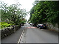
Pit Lane, Lindal-in-Furness
National Cycle Route 70 heading north west.
Image: © JThomas
Taken: 4 Jul 2021
0.15 miles
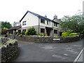
4
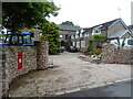
House on Pit Lane, Lindal in Furness
Showing position of Postbox No. LA12 74.
See Image] for postbox.
Image: © JThomas
Taken: 4 Jul 2021
0.20 miles
5
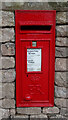
Elizabeth II postbox on Pit Lane, Lindal in Furness
Postbox No. LA12 74.
See Image] for context
Image: © JThomas
Taken: 4 Jul 2021
0.20 miles
6
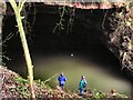
Iron Ore Mine
The Blue Trousers contrast with the drab, now flooded forbidding entrance which gave access to miles of underground workings to this mine known as 'Daylight Hole'.
Image: © Arnold Price
Taken: 1 Feb 2007
0.21 miles
7
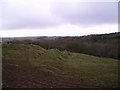
Farmland near Lindal
Possible mining activity has caused the humps. Iron mined extensively in the past, the earth herebouts being bright red.
Image: © Michael Graham
Taken: Unknown
0.25 miles