
IMAGES TAKEN NEAR TO
Cox Street, ULVERSTON, LA12 0AS
Introduction
This page details the photographs taken nearby to Cox Street, LA12 0AS by members of the Geograph project.
The Geograph project started in 2005 with the aim of publishing, organising and preserving representative images for every square kilometre of Great Britain, Ireland and the Isle of Man.

There are currently over 7.5m images from over14,400 individuals and you can help contribute to the project by visiting https://www.geograph.org.uk
Image Map
Images are licensed for reuse under creativecommons.org/licenses/by-sa/2.0
Notes
- Clicking on the map will re-center to the selected point.
- The higher the marker number, the further away the image location is from the centre of the postcode.
Image Listing (210 Images Found)
Images are licensed for reuse under creativecommons.org/licenses/by-sa/2.0
Image
Details
Distance

2

Ulverston fire station
Ulverston fire station, The Ellers, Ulverston, Cumbria
Image: © Kevin Hale
Taken: 30 Jul 2010
0.06 miles
3

Ulverston old fire station
Ulverston old fire station, now used as a St John Ambulance station, The Ellers, Ulverston, Cumbria is adjacent to the current Image
Image: © Kevin Hale
Taken: 30 Jul 2010
0.06 miles


6
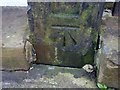
Ordnance Survey Cut Mark
This OS cut mark can be found on the gatepost of Nos21 & 23 Lightburn Road. It marks a point 17.718m above mean sea level.
Image: © Adrian Dust
Taken: 17 Oct 2019
0.07 miles
7

Ellers Mill, Ulverston
A former water powered cotton mill. The cotton industry in the town declined after the cotton famine of 1862 and the mill was variously used for leather, paper, ropes, candles, checks and corn.
Image: © Chris Allen
Taken: 23 Sep 2017
0.07 miles
8

Lanternhouse, Ulverston
A rear view of the building, shown in Image
Image: © Ian Taylor
Taken: 28 Jan 2017
0.08 miles
9
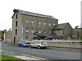
Ellers Mill, Ulverston
A former water powered cotton mill. The cotton industry in the town declined after the cotton famine of 1862 and the mill was variously used for leather, paper, ropes, candles, checks and corn.
Image: © Chris Allen
Taken: 23 Sep 2017
0.08 miles
10

Ulverston's most famous son
No.3 Argyle Street, Ulverston
Image: © John Berry
Taken: 3 Apr 2006
0.08 miles