
IMAGES TAKEN NEAR TO
Brogden Street, ULVERSTON, LA12 0AJ
Introduction
This page details the photographs taken nearby to Brogden Street, LA12 0AJ by members of the Geograph project.
The Geograph project started in 2005 with the aim of publishing, organising and preserving representative images for every square kilometre of Great Britain, Ireland and the Isle of Man.

There are currently over 7.5m images from over14,400 individuals and you can help contribute to the project by visiting https://www.geograph.org.uk
Image Map
Images are licensed for reuse under creativecommons.org/licenses/by-sa/2.0
Notes
- Clicking on the map will re-center to the selected point.
- The higher the marker number, the further away the image location is from the centre of the postcode.
Image Listing (329 Images Found)
Images are licensed for reuse under creativecommons.org/licenses/by-sa/2.0
Image
Details
Distance
1

Ordnance Survey Cut Mark
This OS cut mark can be found on a post NE side of Victoria Road. It marks a point 23.173m above mean sea level.
Image: © Adrian Dust
Taken: 17 Oct 2019
0.02 miles
2

Ulverston : County Road A590
Looking along the A590.
Image: © Lewis Clarke
Taken: 24 Sep 2019
0.03 miles
3

Ulverston : Victoria Road
Looking along Victoria Road off County Road.
Image: © Lewis Clarke
Taken: 24 Sep 2019
0.03 miles
4
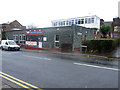
Ulverston Library
Looking across King's Road towards the main entrance of Ulverston Library.
Image: © Graham Robson
Taken: 9 Nov 2012
0.04 miles
5

Art Deco Roxy cinema, Brogden Street, Ulverston
The Roxy is a 1930's art deco cinema which still retains its original decorative features.
Part of it was used by Empire Carpets to sell carpet and floor coverings but in September 2008 the council refused to renew a temporary agreement for such use.
Now the local Laurel and Hardy museum has moved to the cinema but the cinema continues. http://www.nm-cinemas.co.uk/ulverston/
Image: © Alan Cooper
Taken: Unknown
0.04 miles
6

Cast Iron Lamp in Jubilee Gardens
The cast-iron lamp at the centre of Jubilee Gardens originally stood at the centre of County Square.
Jubilee Gardens was originally sited near Coronation Hall and was called “The Rose Garden”. The current garden is on the site of the 1920s Palladium Cinema which was demolished in 1965 when the A590 was built; it was renamed “Jubilee Gardens” in 2012 to mark the Diamond Jubilee of HM Queen Elizabeth II.
Image: © David Dixon
Taken: 23 Aug 2020
0.04 miles

8

Coronation Hall, Ulverston
http://www.corohall.co.uk/
Image: © Alexander P Kapp
Taken: 16 Feb 2010
0.04 miles
9

Laurel & Hardy Museum, Ulverston
Seen from County Road.
Image: © Peter Trimming
Taken: 8 Jul 2014
0.04 miles
10
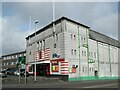
Roxy Cinema, Ulverston
This Art Deco cinema on Brogden Street opened in 1937. The stalls were converted into a bingo hall in the 1970s with the circle continuing as a cinema to this day. The Laurel and Hardy Museum now occupies the ground floor.
The A590 County Road is in the foreground.
Image: © Adrian Taylor
Taken: 27 Feb 2015
0.04 miles