
IMAGES TAKEN NEAR TO
St. James Court, LANCASTER, LA1 1UN
Introduction
This page details the photographs taken nearby to St. James Court, LA1 1UN by members of the Geograph project.
The Geograph project started in 2005 with the aim of publishing, organising and preserving representative images for every square kilometre of Great Britain, Ireland and the Isle of Man.

There are currently over 7.5m images from over14,400 individuals and you can help contribute to the project by visiting https://www.geograph.org.uk
Image Map
Images are licensed for reuse under creativecommons.org/licenses/by-sa/2.0
Notes
- Clicking on the map will re-center to the selected point.
- The higher the marker number, the further away the image location is from the centre of the postcode.
Image Listing (770 Images Found)
Images are licensed for reuse under creativecommons.org/licenses/by-sa/2.0
Image
Details
Distance
1

Lancaster Meeting House
This Quaker meeting house was built in 1708. It was altered in 1769, extended in 1779 and again in 1790. The building was also altered internally in the early 20th century and again in 1969. Listed, grade II*, with details at: https://www.historicengland.org.uk/listing/the-list/list-entry/1211515
The gate piers are also listed with details at: https://www.historicengland.org.uk/listing/the-list/list-entry/1298363
Image: © Michael Dibb
Taken: 25 Jul 2017
0.03 miles
2
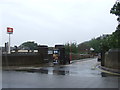
Lancaster station access road
An access road leading to the eastern entrance to Lancaster railway station. The main station building and entrance is on the west side of the station, but the eastern entrance is more convenient for the city centre.
This image was taken on a dismal Bank Holiday in August 2012.
Image: © Malc McDonald
Taken: 27 Aug 2012
0.03 miles
3

Benchmark at east end of north parapet of Meeting House Lane bridge
Ordnance Survey cut mark benchmark levelled at 25.4417m above Newlyn Datum verified 1960
Image: © Roger Templeman
Taken: 25 Jul 2026
0.03 miles
4
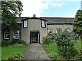
Lancaster - Friends Meeting House
This Quaker Meeting House on Meeting House Lane in Lancaster dates from 1708, with alterations and extensions in 1769, 1779 and 1790. The first Meeting House on the site was built in 1677 and its datestone is set into a doorway in the porch.
It is EH Grade II* listed with a good listing here http://list.english-heritage.org.uk/resultsingle.aspx?uid=1211515&searchtype=mapsearch
Image: © Rob Farrow
Taken: 29 Aug 2012
0.03 miles
5

Friends Meeting House
On Meeting House Lane in Lancaster.
Image: © philandju
Taken: 17 Jul 2017
0.03 miles
6

Cut benchmark on wall of railway bridge, Meeting House Lane, Lancaster
At an altitude of 25.442m asl.
Image: © Karl and Ali
Taken: 8 Jan 2014
0.03 miles
7

The Friends' Meeting House, Lancaster
Located at the end of Meeting House Lane, close to the railway station.
Image: © Peter Trimming
Taken: 3 Sep 2014
0.03 miles
8

Quaker Meeting House
Viewed from Lancaster Station.
Image: © Gerald England
Taken: 5 Apr 2022
0.03 miles
9
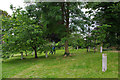
The Storey Gardens
The western section of the gardens during an open day. The concrete plinths were used to support bronze fruit for The Tasting Garden, an artwork by Mark Dion. Unfortunately, the bronzes were stolen. The Friends of Storey Gardens are hoping to reopen the gardens to the public. See http://www.storeygardens.org/
Image: © Ian Taylor
Taken: 28 Jun 2014
0.04 miles
