
IMAGES TAKEN NEAR TO
Queen Street, LANCASTER, LA1 1RS
Introduction
This page details the photographs taken nearby to Queen Street, LA1 1RS by members of the Geograph project.
The Geograph project started in 2005 with the aim of publishing, organising and preserving representative images for every square kilometre of Great Britain, Ireland and the Isle of Man.

There are currently over 7.5m images from over14,400 individuals and you can help contribute to the project by visiting https://www.geograph.org.uk
Image Map
Images are licensed for reuse under creativecommons.org/licenses/by-sa/2.0
Notes
- Clicking on the map will re-center to the selected point.
- The higher the marker number, the further away the image location is from the centre of the postcode.
Image Listing (492 Images Found)
Images are licensed for reuse under creativecommons.org/licenses/by-sa/2.0
Image
Details
Distance
1

Ordnance Survey Cut Mark
This mark can be found on the wall of 14 Queen Street.
For more detail see : http://www.bench-marks.org.uk/bm44538
Image: © Peter Wood
Taken: 4 Aug 2012
0.00 miles
2

5-7 Queen Street, Lancaster
A late C18th or early C19th pair with a variation on the shared doorcase theme elsewhere in the city - here each has one half of a swan-neck pediment (Image]). Grade II listed.
Image: © Stephen Richards
Taken: 13 Jun 2013
0.01 miles
3

Detail of 5-7 Queen Street, Lancaster
A swan-neck pediment spread across a pair of doorcases.
Wider view: Image
Image: © Stephen Richards
Taken: 13 Jun 2013
0.01 miles
4
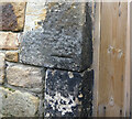
OS Bench Mark
OS cut bench mark from the 20th century levelling on doorway at side of No.2 Lindow St. 22.253 m above datum. The arrows are very eroded.
Image: © Phil Johnstone
Taken: 17 Oct 2021
0.03 miles

6

4-6 Queen Street, Lancaster
A late C18th house with a later canted bay. Grade II listed.
Currently housing Lancashire County Council's Registration Office in the city.
Image: © Stephen Richards
Taken: 13 Jun 2013
0.05 miles
7

Ordnance Survey Cut Mark
This mark can be found on the wall of 4 Queen Street.
For more detail see : http://www.bench-marks.org.uk/bm44539
Image: © Peter Wood
Taken: 4 Aug 2012
0.05 miles
8

The A6 in Lancaster centre
From the top deck of the No.40, Preston-Morecambe bus.
Image: © David Long
Taken: 23 Dec 2008
0.05 miles
9

89-95 King Street, Lancaster
A nice little run of late C18th houses. Grade II listed.
Mostly offices now, but no. 91 was occupied by an Indian restaurant (Moghuls) which has since closed.
Image: © Stephen Richards
Taken: 13 Jun 2013
0.05 miles
10

Looking down South Road towards the Castle and Priory
Image: © mym
Taken: 7 Jun 2000
0.05 miles