
IMAGES TAKEN NEAR TO
Sugar House Alley, LANCASTER, LA1 1NW
Introduction
This page details the photographs taken nearby to Sugar House Alley, LA1 1NW by members of the Geograph project.
The Geograph project started in 2005 with the aim of publishing, organising and preserving representative images for every square kilometre of Great Britain, Ireland and the Isle of Man.

There are currently over 7.5m images from over14,400 individuals and you can help contribute to the project by visiting https://www.geograph.org.uk
Image Map
Images are licensed for reuse under creativecommons.org/licenses/by-sa/2.0
Notes
- Clicking on the map will re-center to the selected point.
- The higher the marker number, the further away the image location is from the centre of the postcode.
Image Listing (470 Images Found)
Images are licensed for reuse under creativecommons.org/licenses/by-sa/2.0
Image
Details
Distance
1

St Leonard's House, St Leonard's Gate, Lancaster
Built as Gillow's furniture factory, the near range in 1882-83, and the further block in the mid C20th. Grade II listed.
I think it may now be student accommodation - this appears to be a safe bet when in doubt about the function of any building in Lancaster. It includes a student nightclub, the Sugarhouse.
Image: © Stephen Richards
Taken: 12 Jun 2013
0.01 miles
2

50 St Leonard's Gate, Lancaster
One of few disused buildings in Lancaster for which conversion into student accommodation does not appear to be on the cards. At some point attached to King's Community Church. Dated 1887.
Image: © Stephen Richards
Taken: 12 Jun 2013
0.02 miles
3
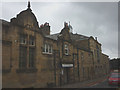
Former World War One Drill Hall, Phoenix Street, Lancaster
Now the King's Community Church http://www.kcc.org.uk/
Image: © Karl and Ali
Taken: 30 Jul 2014
0.03 miles
4

'Rifle Volunteer Drill Hall'
Carved above the entrance of Image
Image: © Karl and Ali
Taken: 30 Jul 2014
0.03 miles
5

OS Bench Mark (remains)
OS cut bench mark from the 19th century levelling, on the corner of Phoenix Street and St Leonard's Gate. 43.7 feet above old datum. Due to spalling of the sandstone, only the horizontal bar and right-hand diagonal are still visible.
Image: © Phil Johnstone
Taken: 19 Aug 2021
0.03 miles
6

Buildings on SE side of North Street
The building with scaffolding is being converted to student accommodation. Ordnance Survey records indicate that in 1960 a benchmark levelled at 7.090m above Newlyn Datum was verified on the near corner of the building, see www.bench-marks.org.uk/bm112485
Image: © Luke Shaw
Taken: 5 Jul 2019
0.04 miles
7

Lancaster Fire Station
From the top deck of the No.40, Preston-Morecambe bus.
Image: © David Long
Taken: 23 Dec 2008
0.05 miles

9

The Yorkshire House, Lancaster
Public house on Parliament Street.
Image: © JThomas
Taken: 26 Sep 2015
0.05 miles
10

OS Bench Mark
OS cut bench mark from the first, 19th century, levelling, at corner of Phoenix Street and Parliament Street. 26.8 feet above old datum. Rather weathered.
Image: © Phil Johnstone
Taken: 24 Aug 2021
0.05 miles