
IMAGES TAKEN NEAR TO
Howgill Lane, SEDBERGH, LA10 5HE
Introduction
This page details the photographs taken nearby to Howgill Lane, LA10 5HE by members of the Geograph project.
The Geograph project started in 2005 with the aim of publishing, organising and preserving representative images for every square kilometre of Great Britain, Ireland and the Isle of Man.

There are currently over 7.5m images from over14,400 individuals and you can help contribute to the project by visiting https://www.geograph.org.uk
Image Map
Images are licensed for reuse under creativecommons.org/licenses/by-sa/2.0
Notes
- Clicking on the map will re-center to the selected point.
- The higher the marker number, the further away the image location is from the centre of the postcode.
Image Listing (15 Images Found)
Images are licensed for reuse under creativecommons.org/licenses/by-sa/2.0
Image
Details
Distance

2

Lockbank Farm
The farm governs one of the main access routes to Winder.
Image: © Bill Boaden
Taken: 17 May 2014
0.09 miles
3

Lockbank Farm, Sedbergh
This photograph shows a view of Lockbank Farm which is located near Howgill Lane on the west side of Sedbergh. A part of the path that runs between Howgill Lane and Calders is just visible on the left-hand side of the wall seen in the foreground of the image. The picture was taken looking in a westerly direction towards the River Lune.
Image: © Philip Barker
Taken: 6 Jun 2010
0.11 miles
4

Footpath down to Sedbergh
Looking towards the town of Sedbergh and the Rawthey Valley, which are shrouded in a misty cloud. This inclement weather means we have decided to cut out the Dales Way's loop along the Rawthey and Lune.
Image: © Tim Heaton
Taken: 8 Jul 2016
0.16 miles
5

On the way down from Winder
Looking ahead towards Lockbank Farm and the houses of the west side of Sedbergh.
Image: © Rich Tea
Taken: 7 Sep 2022
0.17 miles
6

Howgill Lane, gatepost benchmark
Ordnance Survey cut mark benchmark on gatepost near Lockbank Farm showing damage to left hand side arrow cut due to stone lamination. The mark was levelled at 165.7868m above Newlyn datum and verified in 1953. Additional information on this mark and others nearby may be found on the Bench Mark Database at http://www.bench-marks.org.uk/bm30912
Image: © Roger Templeman
Taken: 23 Jul 2009
0.17 miles
7
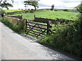
Sedbergh, Howgill Lane
View of fields above Sedbergh through gateway, the left hand gatepost of which carries an Ordnance Survey benchmark Image at the height of the second bar.
Image: © Roger Templeman
Taken: 23 Jul 2009
0.17 miles

9
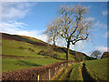
Large ash by Howgill Lane above Sedbergh
If the ash dieback fungus spreads then trees like this will become a thing of the past.
Image: © Karl and Ali
Taken: 10 Nov 2012
0.21 miles
10

Green fields in Lonsdale
Looking down from the lower slopes of Winder, with the fields a healthy springtime green.
Image: © Bill Boaden
Taken: 17 May 2014
0.22 miles