
IMAGES TAKEN NEAR TO
Woodside Avenue, SEDBERGH, LA10 5EY
Introduction
This page details the photographs taken nearby to Woodside Avenue, LA10 5EY by members of the Geograph project.
The Geograph project started in 2005 with the aim of publishing, organising and preserving representative images for every square kilometre of Great Britain, Ireland and the Isle of Man.

There are currently over 7.5m images from over14,400 individuals and you can help contribute to the project by visiting https://www.geograph.org.uk
Image Map
Images are licensed for reuse under creativecommons.org/licenses/by-sa/2.0
Notes
- Clicking on the map will re-center to the selected point.
- The higher the marker number, the further away the image location is from the centre of the postcode.
Image Listing (130 Images Found)
Images are licensed for reuse under creativecommons.org/licenses/by-sa/2.0
Image
Details
Distance

2

Barn
Farm building on outskirts of Sedbergh, below the Howgills.
Image: © William Metcalfe
Taken: 14 Apr 2007
0.06 miles
3

Children's play area
Playground in public park beneath the spectacular Howgills.
Image: © William Metcalfe
Taken: 14 Apr 2007
0.06 miles

5

Play park in Sedbergh
When you have graduated from the climbing frames you can climb Winder, the hill in the background.
Image: © Russel Wills
Taken: 24 Oct 2018
0.10 miles

7
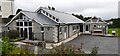
People's Hall on west side of Howgill Lane
Image: © Roger Templeman
Taken: 6 Jul 2022
0.11 miles
8

Sedbergh, Howgill Lane and barn
Howgill Lane runs north from Sedbergh. There is an Ordnance Survey cut mark benchmark on the south angle of the barn on the NE side of the lane. The mark was levelled at 135.819m above Newlyn datum and verified in 1953. More information on this mark and nearby benchmarks can be found on the Bench Mark Database at http://www.bench-marks.org.uk/bm24433
Image: © Roger Templeman
Taken: 23 Jul 2009
0.12 miles
9

Sedbergh, Howgill Lane
There is an Ordnance Survey benchmark Image on the near corner of the barn which is on NE side of Howgill Lane which runs north out of Sedbergh.
Image: © Roger Templeman
Taken: 23 Jul 2009
0.12 miles
10

Footpath down to Sedbergh
Looking towards the town of Sedbergh and the Rawthey Valley, which are shrouded in a misty cloud. This inclement weather means we have decided to cut out the Dales Way's loop along the Rawthey and Lune.
Image: © Tim Heaton
Taken: 8 Jul 2016
0.13 miles