IMAGES TAKEN NEAR TO
Spire Green, LIVERPOOL, L9 2DR
Introduction
This page details the photographs taken nearby to Spire Green, L9 2DR by members of the Geograph project.
The Geograph project started in 2005 with the aim of publishing, organising and preserving representative images for every square kilometre of Great Britain, Ireland and the Isle of Man.

There are currently over 7.5m images from over14,400 individuals and you can help contribute to the project by visiting https://www.geograph.org.uk
Image Map
Images are licensed for reuse under creativecommons.org/licenses/by-sa/2.0
Notes
- Clicking on the map will re-center to the selected point.
- The higher the marker number, the further away the image location is from the centre of the postcode.
Image Listing (43 Images Found)
Images are licensed for reuse under creativecommons.org/licenses/by-sa/2.0
Image
Details
Distance
1
Blessed Sacrament roman Catholic Church, Orell Park
Image: © Eirian Evans
Taken: 9 May 2016
0.04 miles
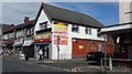
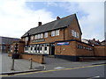
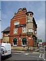
2
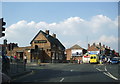
The Windsor, 1 Walton Vale, Liverpool 9
Image: © Alexander P Kapp
Taken: 8 May 2008
0.06 miles
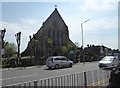
5
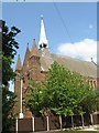
St John the Evangelist Church
St John the Evangelist Church, Walton, Rice Lane, consecrated September 10th 1880.
Image: © Sue Adair
Taken: 24 May 2008
0.07 miles
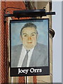
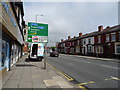
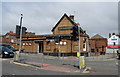
7
Joey Orrs public house
Listed building on Rice Lane.
Image: © JThomas
Taken: 28 Apr 2019
0.08 miles