IMAGES TAKEN NEAR TO
Buttercup Way, LIVERPOOL, L9 1JQ
Introduction
This page details the photographs taken nearby to Buttercup Way, L9 1JQ by members of the Geograph project.
The Geograph project started in 2005 with the aim of publishing, organising and preserving representative images for every square kilometre of Great Britain, Ireland and the Isle of Man.

There are currently over 7.5m images from over14,400 individuals and you can help contribute to the project by visiting https://www.geograph.org.uk
Image Map
Images are licensed for reuse under creativecommons.org/licenses/by-sa/2.0
Notes
- Clicking on the map will re-center to the selected point.
- The higher the marker number, the further away the image location is from the centre of the postcode.
Image Listing (3 Images Found)
Images are licensed for reuse under creativecommons.org/licenses/by-sa/2.0
Image
Details
Distance
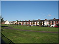
2

Railway path alongside Hartleys
This may look like a rural footpath but the security fence to the right gives a clue. It surrounds the former Hartleys jam factory Image
Image: © Stephen Craven
Taken: 4 Nov 2017
0.23 miles
3
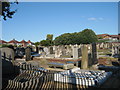
Rice Lane Jewish Cemetery
Rice Lane Jewish Cemetery in Hazeldale Road was in use from 1896 until 1983.
Image: © Sue Adair
Taken: 10 Aug 2017
0.23 miles