IMAGES TAKEN NEAR TO
Jubilee Drive, LIVERPOOL, L7 8SL
Introduction
This page details the photographs taken nearby to Jubilee Drive, L7 8SL by members of the Geograph project.
The Geograph project started in 2005 with the aim of publishing, organising and preserving representative images for every square kilometre of Great Britain, Ireland and the Isle of Man.

There are currently over 7.5m images from over14,400 individuals and you can help contribute to the project by visiting https://www.geograph.org.uk
Image Map
Images are licensed for reuse under creativecommons.org/licenses/by-sa/2.0
Notes
- Clicking on the map will re-center to the selected point.
- The higher the marker number, the further away the image location is from the centre of the postcode.
Image Listing (10 Images Found)
Images are licensed for reuse under creativecommons.org/licenses/by-sa/2.0
Image
Details
Distance
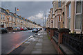
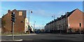
2
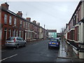
A pedestrian route continues Ingrow Road
Ball games are prohibited despite there being no windows or cars.
Image: © Ian Greig
Taken: 2 Jan 2015
0.15 miles
5
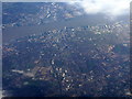
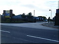
Liverpool and the River Mersey
A long view, looking west from near Warrington. The red stadium mid right is Anfield and Goodison Park is to the right of that.
Image: © M J Richardson
Taken: 23 Nov 2017
0.19 miles
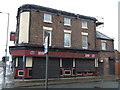
6
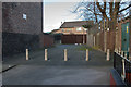
Rocastle Close
The roof of Kensington Street Garage can be seen at the end of the close.
Image: © Mark Anderson
Taken: 29 Oct 2024
0.22 miles
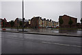
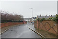
8
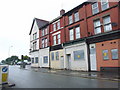
Boarded up properties on Edge Lane, Kensington
Image: © Chris Whippet
Taken: 26 Jul 2010
0.23 miles