IMAGES TAKEN NEAR TO
Teign Close, LIVERPOOL, L6 2PL

Introduction

This page details the photographs taken nearby to Teign Close, L6 2PL by members of the Geograph project.

The Geograph project started in 2005 with the aim of publishing, organising and preserving representative images for every square kilometre of Great Britain, Ireland and the Isle of Man.

There are currently over 7.5m images from over14,400 individuals and you can help contribute to the project by visiting https://www.geograph.org.uk

Image Map


Images are licensed for reuse under creativecommons.org/licenses/by-sa/2.0
Notes
  • Clicking on the map will re-center to the selected point.
  • The higher the marker number, the further away the image location is from the centre of the postcode.

Image Listing (31 Images Found)

Images are licensed for reuse under creativecommons.org/licenses/by-sa/2.0
  • ...
Image
Details
Distance
1
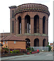
Tavy Road, Liverpool
Smart bungalows dominated by the water tower shown in Image
Image: © Derek Harper Taken: 17 Jul 2006
0.04 miles
2
St John Chrysostom Church, Everton
A slender fleche graces this church on Queen's Road.
Image: © Derek Harper Taken: 17 Jul 2006
0.07 miles
3
St John Chrysostom Church, Everton
A view of Image from the other direction along Queen's Road.
Image: © Derek Harper Taken: 17 Jul 2006
0.07 miles
4
Water works, Margaret Street, Liverpool
Another view of Image] https://historicengland.org.uk/listing/the-list/list-entry/1070630 .
Image: © Derek Harper Taken: 17 Jul 2006
0.07 miles
5
Water works, Margaret Street, Liverpool (1)
A remarkable spectacle, looming over the surrounding houses. Pevsner describes it as "one of the most impressive monuments of C19 Liverpool". The 85-foot tower dates from 1857, a covered reservoir having preceded it by three years (now gone). The two tiers of open arches are dramatic and open up tantalising vistas (even if nowadays they are only of back gardens). To the left is a square-towered pump house, and a later one stands just out of shot (Image]). All this is the work of Thomas Duncan, Liverpool Corporation's water engineer. Grade II listed.
Image: © Stephen Richards Taken: 28 Jul 2011
0.07 miles
6
The Whitefield, Everton
Disused pub with the Queen's Road crossing the picture behind, and Everton water tower in the rear.
Image: © Derek Harper Taken: 17 Jul 2006
0.07 miles
7
Water works, Margaret Street, Liverpool (2)
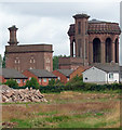
A remarkable spectacle, looming over the surrounding houses. Pevsner describes it as "one of the most impressive monuments of C19 Liverpool". The 85-foot tower (Image]) dates from 1857, a covered reservoir having preceded it by three years (now gone). The two tiers of open arches are dramatic and open up tantalising vistas (even if nowadays they are only of back gardens). Adjoining it is a square-towered pump house, and another, added in the 1860s, stands to the left. All this is the work of Thomas Duncan, Liverpool Corporation's water engineer. Grade II listed.
Image: © Stephen Richards Taken: 28 Jul 2011
0.08 miles
8
The Brunel public house, Liverpool
Image: © JThomas Taken: 28 Apr 2019
0.08 miles
9
Water works, Margaret Street, Liverpool
These 1857 buildings are also shown in http://www.geograph.org.uk/search.php?i=40170751 . See https://historicengland.org.uk/listing/the-list/list-entry/1208230 and https://historicengland.org.uk/listing/the-list/list-entry/1070630 .
Image: © Derek Harper Taken: 17 Jul 2006
0.10 miles
10
Sign for the Brunel public house, Liverpool
Image: © JThomas Taken: 28 Apr 2019
0.10 miles
  • ...