
IMAGES TAKEN NEAR TO
Centenary Close, LIVERPOOL, L4 8UX
Introduction
This page details the photographs taken nearby to Centenary Close, L4 8UX by members of the Geograph project.
The Geograph project started in 2005 with the aim of publishing, organising and preserving representative images for every square kilometre of Great Britain, Ireland and the Isle of Man.

There are currently over 7.5m images from over14,400 individuals and you can help contribute to the project by visiting https://www.geograph.org.uk
Image Map
Images are licensed for reuse under creativecommons.org/licenses/by-sa/2.0
Notes
- Clicking on the map will re-center to the selected point.
- The higher the marker number, the further away the image location is from the centre of the postcode.
Image Listing (10 Images Found)
Images are licensed for reuse under creativecommons.org/licenses/by-sa/2.0
Image
Details
Distance
1
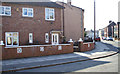
Newer extension to Victorian end of Woodland road
View of the Victorian end of Woodland road with the start of the extension built after WW1 by Liverpool corporation. No 24 narrowly missed destruction when an incendiary bomb hit the pavement at the gate in the May blitz just missing the house. The tenant, Frank Lewis was able to extinguish the blaze with a sandbag that the corporation had thoughtfully provided on the doorsteps of every house.
Image: © stan lewis
Taken: 11 Mar 2010
0.05 miles
5
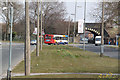
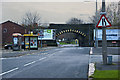
Utting Avenue at Bootle branch railway bridge
Utting Avenue was one of the many wide avenues created by John Brodie. At this point it narrows down to pass through the arch bridge carrying the Edge Hill to Bootle branch of the London and North Western Railway. Trams converged onto a single track in the roadway under the bridge in contrast to the separate reservation on either side of the bridge.
Image: © Alan Murray-Rust
Taken: 8 Apr 2013
0.14 miles
6
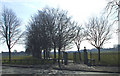
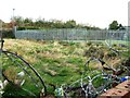
Clubmoor park
Local recreation ground that housed a searchlight unit in early WW2 and was later filled with Sherman tanks prior to D-day. At the far corner was Clubmoor station and Breck park railway sidings where ammunition trucks were sent from the docks for safety but caught fire in the May blitz causing much local damage. The field was later bounded with prefabricated houses.
Image: © stan lewis
Taken: 11 Mar 2010
0.15 miles
7

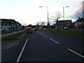
Queens Drive approaching Richard Kelly Drive
An unusual crossroads for Queens Drive in that no traffic lights are provided. There is, instead, reliance on the wide central reservation for turns and queue space for traffic crossing Queens Drive.
Image: © Peter Whatley
Taken: 17 Jan 2012
0.20 miles
8

Elizabeth II postbox on Queens Drive Walton
Postbox No. L4 749.
See Image] for context.
Image: © JThomas
Taken: 28 Apr 2019
0.22 miles
9
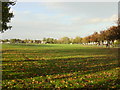
Recreation Ground, Cherry Lane
This recreation ground between Townsend and Cherry Lane is popular with local football teams on Saturdays and Sundays
Image: © Sue Adair
Taken: 31 Oct 2005
0.23 miles
10
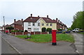
Houses on Queens Drive Walton
Showing position of Postbox No. L4 749.
See Image] for context.
Image: © JThomas
Taken: 28 Apr 2019
0.24 miles