IMAGES TAKEN NEAR TO
Vanbrugh Road, LIVERPOOL, L4 7TU
Introduction
This page details the photographs taken nearby to Vanbrugh Road, L4 7TU by members of the Geograph project.
The Geograph project started in 2005 with the aim of publishing, organising and preserving representative images for every square kilometre of Great Britain, Ireland and the Isle of Man.

There are currently over 7.5m images from over14,400 individuals and you can help contribute to the project by visiting https://www.geograph.org.uk
Image Map
Images are licensed for reuse under creativecommons.org/licenses/by-sa/2.0
Notes
- Clicking on the map will re-center to the selected point.
- The higher the marker number, the further away the image location is from the centre of the postcode.
Image Listing (6 Images Found)
Images are licensed for reuse under creativecommons.org/licenses/by-sa/2.0
Image
Details
Distance
1
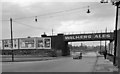
Site of Breck Road Station
View eastward on Townsend Lane. Station had been on the left; ex-London & North Western Bootle Branch, Edge Hill - Alexandra Dock/Canada Dock. The station was closed to passengers 31/5/48 when the local service was withdrawn, to goods on 8/9/69, but this important line to the Docks (Liverpool Freeport) remains operational.
Image: © Ben Brooksbank
Taken: 9 Sep 1962
0.11 miles

3
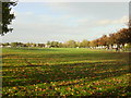
Recreation Ground, Cherry Lane
This recreation ground between Townsend and Cherry Lane is popular with local football teams on Saturdays and Sundays
Image: © Sue Adair
Taken: 31 Oct 2005
0.14 miles
4

Bus stop and shelter on Townsend Lane (A580)
Image: © JThomas
Taken: 28 Apr 2019
0.20 miles
5
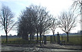
Clubmoor park
Local recreation ground that housed a searchlight unit in early WW2 and was later filled with Sherman tanks prior to D-day. At the far corner was Clubmoor station and Breck park railway sidings where ammunition trucks were sent from the docks for safety but caught fire in the May blitz causing much local damage. The field was later bounded with prefabricated houses.
Image: © stan lewis
Taken: 11 Mar 2010
0.20 miles