IMAGES TAKEN NEAR TO
Cherry Avenue, LIVERPOOL, L4 6UY
Introduction
This page details the photographs taken nearby to Cherry Avenue, L4 6UY by members of the Geograph project.
The Geograph project started in 2005 with the aim of publishing, organising and preserving representative images for every square kilometre of Great Britain, Ireland and the Isle of Man.

There are currently over 7.5m images from over14,400 individuals and you can help contribute to the project by visiting https://www.geograph.org.uk
Image Map
Images are licensed for reuse under creativecommons.org/licenses/by-sa/2.0
Notes
- Clicking on the map will re-center to the selected point.
- The higher the marker number, the further away the image location is from the centre of the postcode.
Image Listing (6 Images Found)
Images are licensed for reuse under creativecommons.org/licenses/by-sa/2.0
Image
Details
Distance
1
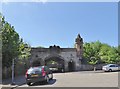
Cherry Lane entrance to Anfield Cemetery
The entrance at the north-east corner of Anfield Cemetery is formed by an elaborate bridge carrying the railway line and has a central arched tunnel flanked by subsidiary tunnels, all with ornate cast-iron gates (listed grade II). This is known as the Cherry Lane entrance after the road with which it connects.
Image: © Eirian Evans
Taken: 14 May 2016
0.09 miles
2
Queens Drive nearing Atheldene Road
A car can be seen on the right about to exit Atheldene Road.
Image: © Peter Whatley
Taken: 17 Jan 2012
0.22 miles
3
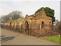
Northern Catacomb Entrance Building, Anfield Cemetery, Liverpool
The northern one of a pair of buildings which form the entrances to a pair of catacombs under Anfield Cemetery. Both buildings date from the late 19th Century and are long derelict. The building is grade II listed. https://www.historicengland.org.uk/listing/the-list/list-entry/1068390
Image: © Graham Robson
Taken: 13 Mar 2016
0.23 miles
4
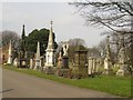
Monuments in Anfield Cemetery
A row of elaborate monuments to the dead of Liverpool in a line alongside one of the paths in Anfield Cemetery.
Image: © Graham Robson
Taken: 13 Mar 2016
0.23 miles
5
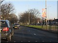
Eastern end of Walton Hall Avenue (A580)
The "docks" arm of the East Lancashire Road from its junction with Queens Drive.
Image: © Peter Whatley
Taken: 17 Jan 2012
0.24 miles