
IMAGES TAKEN NEAR TO
Anfield Road, LIVERPOOL, L4 0TD
Introduction
This page details the photographs taken nearby to Anfield Road, L4 0TD by members of the Geograph project.
The Geograph project started in 2005 with the aim of publishing, organising and preserving representative images for every square kilometre of Great Britain, Ireland and the Isle of Man.

There are currently over 7.5m images from over14,400 individuals and you can help contribute to the project by visiting https://www.geograph.org.uk
Image Map
Images are licensed for reuse under creativecommons.org/licenses/by-sa/2.0
Notes
- Clicking on the map will re-center to the selected point.
- The higher the marker number, the further away the image location is from the centre of the postcode.
Image Listing (99 Images Found)
Images are licensed for reuse under creativecommons.org/licenses/by-sa/2.0
Image
Details
Distance
1
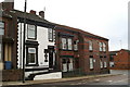
Anfield Road variety
Terraced houses are synonymous with uniformity - but not so this group opposite Stanley Park, near the junction with Sleepers Hill. The black-and-white one is called Belmont Cottage and its build date of 1885 is written above the door, and below the step.
Image: © David Long
Taken: 15 Nov 2008
0.01 miles
2

Saker Street/ Sleepers Hill junction
Three roads head east off Sleepers Hill to join it to Blessington Road. The others are Norgate and Attwood Streets. I have been unable to discover a link between these names. A saker is a kind of falcon, which provides no link. There was an actor/ manager called Edward Saker (1838-83), but I cannot find any Norgates or Attwoods with a similar background.
Image: © David Long
Taken: 15 Nov 2008
0.02 miles
3

Lodge, Stanley Park
The red sandstone lodge dates from 1868 https://historicengland.org.uk/listing/the-list/list-entry/1063332 . The screen wall is described at https://historicengland.org.uk/listing/the-list/list-entry/1359842 .
Image: © Derek Harper
Taken: 17 Jul 2006
0.02 miles
4
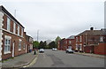
Sleepers Hill
Looking north towards Anfield Road.
Image: © JThomas
Taken: 28 Apr 2019
0.04 miles
5
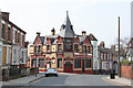
The King Harry
A Victorian pub of 1885 on the corner of Anfield Road and Blessington Road which has had a serious facelift. Note also the flamboyant terracotta decoration in the gable panels.
Image: © Alan Murray-Rust
Taken: 8 Apr 2013
0.04 miles
6
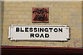
Blessington Road
Typical City of Liverpool cast iron street nameplate, complemented here with an ornate terracotta insert panel on the King Harry pub http://www.geograph.org.uk/photo/3408939.
Image: © Alan Murray-Rust
Taken: 8 Apr 2013
0.04 miles

8
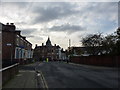
The King Harry, Anfield Road
Near the junction with Rockfield Road. Anfield Road is closed to traffic here, and fans are directed up Back Rockfield Road to the football stadium.
Image: © Peter Barr
Taken: 4 Nov 2012
0.04 miles
9
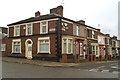
Bodley Street/ Sleepers Hill junction
The bit of fancy work on the end of Bodley Street may be explained by the fact that the other end of the street comes off Walton Lane, and the streets off each side are named after Victoria Architects. George Frederick Bodley (1827-1907) was a Gothic Revivalist famous for his church work. Others on the same stretch leading up to Sleepers Hill were Butterfield, Goldie, Paley and Nesfield Streets.
Image: © David Long
Taken: 15 Nov 2008
0.04 miles
10
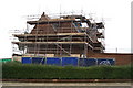
Restoration of lodge, Stanley Park
From Anfield Road
Image: © David Long
Taken: 15 Nov 2008
0.05 miles