IMAGES TAKEN NEAR TO
Bowkers Green Lane, ORMSKIRK, L39 9ER
Introduction
This page details the photographs taken nearby to Bowkers Green Lane, L39 9ER by members of the Geograph project.
The Geograph project started in 2005 with the aim of publishing, organising and preserving representative images for every square kilometre of Great Britain, Ireland and the Isle of Man.

There are currently over 7.5m images from over14,400 individuals and you can help contribute to the project by visiting https://www.geograph.org.uk
Image Map
Images are licensed for reuse under creativecommons.org/licenses/by-sa/2.0
Notes
- Clicking on the map will re-center to the selected point.
- The higher the marker number, the further away the image location is from the centre of the postcode.
Image Listing (17 Images Found)
Images are licensed for reuse under creativecommons.org/licenses/by-sa/2.0
Image
Details
Distance
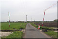
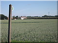
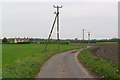
1
Public footpath sign on Bowker's Green Lane
Fogg's House in background
Image: © Raymond Knapman
Taken: 15 Nov 2010
0.06 miles
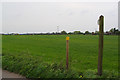
3
Footpath from Bowker's Green Lane to Billinges Farm
Image: © Gary Rogers
Taken: 30 Apr 2017
0.09 miles
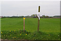
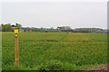
4
Not really a footpath, Bowker's Green Lane
One of a number of public footpaths in this area which are overplanted with crops.
Image: © Chris Denny
Taken: 20 Jun 2010
0.12 miles
5
Footpath from Billinges Lane to Bowker's Green Lane, Aughton
Image: © Gary Rogers
Taken: 30 Apr 2017
0.13 miles
6
Footpath between Cunscough Lane and Bowker's Green Lane
Image: © Gary Rogers
Taken: 30 Apr 2017
0.14 miles
7
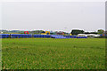
Laying new gas pipeline near Royal Oak Farm, Bowker's Green Lane, Aughton
Image: © Gary Rogers
Taken: 30 Apr 2017
0.14 miles
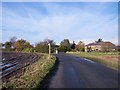
9
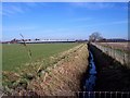
Ditch on Bowker's Green Road
View showing farm buildings of Lower End Farm
Image: © Raymond Knapman
Taken: 15 Nov 2010
0.15 miles