IMAGES TAKEN NEAR TO
Narrow Lane, ORMSKIRK, L39 7LJ
Introduction
This page details the photographs taken nearby to Narrow Lane, L39 7LJ by members of the Geograph project.
The Geograph project started in 2005 with the aim of publishing, organising and preserving representative images for every square kilometre of Great Britain, Ireland and the Isle of Man.

There are currently over 7.5m images from over14,400 individuals and you can help contribute to the project by visiting https://www.geograph.org.uk
Image Map
Images are licensed for reuse under creativecommons.org/licenses/by-sa/2.0
Notes
- Clicking on the map will re-center to the selected point.
- The higher the marker number, the further away the image location is from the centre of the postcode.
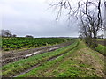
Image Listing (10 Images Found)
Images are licensed for reuse under creativecommons.org/licenses/by-sa/2.0
Image
Details
Distance
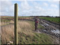
3
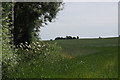
Fields beside Cut Lane, Clieves Hill, Aughton
Image: © Mike Pennington
Taken: 3 Jul 2015
0.19 miles
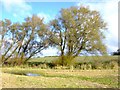
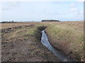
6
Crop of Kale on Cut Lane at Clieves Hills
Drainage ditch seen on the right
Image: © Raymond Knapman
Taken: 12 Jan 2015
0.21 miles
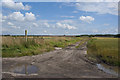
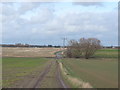
7
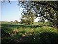
Track off Cut Lane
A timeless scene in the West Lancashire countryside.
Image: © Chris Denny
Taken: 17 May 2010
0.23 miles