IMAGES TAKEN NEAR TO
Whittle Drive, ORMSKIRK, L39 1PU
Introduction
This page details the photographs taken nearby to Whittle Drive, L39 1PU by members of the Geograph project.
The Geograph project started in 2005 with the aim of publishing, organising and preserving representative images for every square kilometre of Great Britain, Ireland and the Isle of Man.

There are currently over 7.5m images from over14,400 individuals and you can help contribute to the project by visiting https://www.geograph.org.uk
Image Map
Images are licensed for reuse under creativecommons.org/licenses/by-sa/2.0
Notes
- Clicking on the map will re-center to the selected point.
- The higher the marker number, the further away the image location is from the centre of the postcode.
Image Listing (10 Images Found)
Images are licensed for reuse under creativecommons.org/licenses/by-sa/2.0
Image
Details
Distance
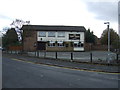
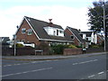
3
Yew Tree Road, Ormskirk
Heading south east.
Image: © JThomas
Taken: 25 Oct 2014
0.16 miles
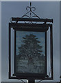
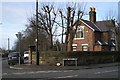
5

Our "local"
At the junction of Yew Tree Road and Grimshaw Lane.
Image: © Bryan Pready
Taken: 5 Oct 2008
0.19 miles
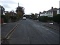
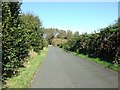
6
What's in a name?
Is this a lane over a narrow moss, or a narrow lane over a moss?
Image: © David Long
Taken: 17 Feb 2006
0.20 miles
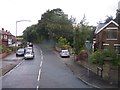
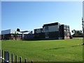
9
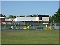
New playground
With Ormskirk West End Primary School beyond
Image: © Bryan Pready
Taken: 4 Jun 2008
0.21 miles