IMAGES TAKEN NEAR TO
Intake Lane, ORMSKIRK, L39 0HW
Introduction
This page details the photographs taken nearby to Intake Lane, L39 0HW by members of the Geograph project.
The Geograph project started in 2005 with the aim of publishing, organising and preserving representative images for every square kilometre of Great Britain, Ireland and the Isle of Man.

There are currently over 7.5m images from over14,400 individuals and you can help contribute to the project by visiting https://www.geograph.org.uk
Image Map
Images are licensed for reuse under creativecommons.org/licenses/by-sa/2.0
Notes
- Clicking on the map will re-center to the selected point.
- The higher the marker number, the further away the image location is from the centre of the postcode.
Image Listing (6 Images Found)
Images are licensed for reuse under creativecommons.org/licenses/by-sa/2.0
Image
Details
Distance
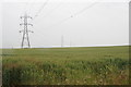
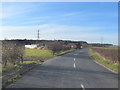
1
Intake Lane near Bickerstaffe
Intake Farm buildings seen on the left
Image: © Raymond Knapman
Taken: 10 Nov 2010
0.01 miles
3
Intake Farm on Intake Lane, Bickerstaffe
Image: © Gary Rogers
Taken: 14 Mar 2016
0.03 miles
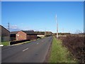
4
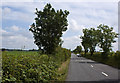
Intake Lane with a classic car approaching
Image: © Ian Greig
Taken: 9 Jul 2011
0.18 miles