IMAGES TAKEN NEAR TO
Ashdale Close, LIVERPOOL, L37 2LG
Introduction
This page details the photographs taken nearby to Ashdale Close, L37 2LG by members of the Geograph project.
The Geograph project started in 2005 with the aim of publishing, organising and preserving representative images for every square kilometre of Great Britain, Ireland and the Isle of Man.

There are currently over 7.5m images from over14,400 individuals and you can help contribute to the project by visiting https://www.geograph.org.uk
Image Map
Images are licensed for reuse under creativecommons.org/licenses/by-sa/2.0
Notes
- Clicking on the map will re-center to the selected point.
- The higher the marker number, the further away the image location is from the centre of the postcode.
Image Listing (40 Images Found)
Images are licensed for reuse under creativecommons.org/licenses/by-sa/2.0
Image
Details
Distance
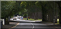
3
Turf zone KirklakeRoad
Green on Kirklake Road, Formby.
Image: © Ian S
Taken: 16 Jun 2023
0.06 miles
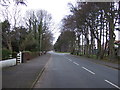
7

St Lukes Church Road
From the end of the road here a path to the left leads off to the dunes and beach.
Image: © Trevor Harris
Taken: 19 Aug 2010
0.13 miles
9
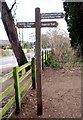
Signpost at entrance to the Pine woods
Image: © Norman Caesar
Taken: 14 Mar 2013
0.14 miles