1
Tarbock Road
Image: © Ian Greig
Taken: 27 Sep 2013
0.11 miles
2
Roundabout and shops at Tarbock Road
Junction of Tarbock Road with Roby Road, Archway Road and Blacklow Brow.
Image: © Sue Adair
Taken: 26 Dec 2016
0.14 miles
3
Postbox, Blacklow Brow
Outside Huyton Station. This is an unusually large box for a wall box, so I included the car to give a sense of scale.
Image: © Alan Murray-Rust
Taken: 5 Oct 2008
0.15 miles
4
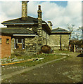
Huyton Station about 1970 - goods yard off platform 1
This small goods yard occasionally saw a LNWR G2a shunting up to about 1960. The red-brick toilet block was built about the time of the photograph (about 1970) to replace one on the redundant platform 4, but it was soon padlocked out of use.
Image: © John Martin
Taken: Unknown
0.15 miles
5
Huyton Station about 1970 - commuters' train
A DMU disgorges a heavy load of passengers from Lime Street at just after 5pm. Huyton Station was inconceivably posted for closure by Dr Beeching; it is now a very busy station, with an excellent and frequent local service.
Image: © John Martin
Taken: Unknown
0.15 miles
6
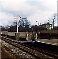
Huyton Station, about 1970
View looking west to Liverpool. DMU at platform 2 on the Manchester line.
Image: © John Martin
Taken: Unknown
0.15 miles
7
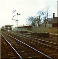
Huyton Station about 1970 - platform ends
View looking south across the platform ends at the east end of Huyton Station. Line visible (platform 3) out of use, nearest line (platform 4) taken up. These were the two slow lines, which veered off to Wigan a few yards to the east. Wigan trains now cross to the other two platforms. Nice signs! Please contact if you can date the shot by the closure of the two slow lines.
Image: © John Martin
Taken: Unknown
0.15 miles
8
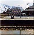
Huyton Station about 1970 - subway from middle platform
Two youngsters dangle their legs precariously, though the line was by now closed into platform 3. The subway was a magical spooky place with echoes and shadows, linking Huyton Village (left) via the station to Blacklow Brow. Originally, when the station was called Huyton Gate, there was a level crossing here instead. Another subway linked the four platforms, and this survives in part.
Image: © John Martin
Taken: Unknown
0.15 miles
9
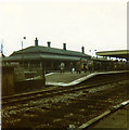
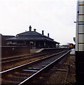
Huyton Station about 1970 - platform 1
The attractive and historic main station buildings on platform 1 at Huyton (on the fast line from Manchester Victoria, earlier Exchange) A DMU stands at platform 2.
Image: © John Martin
Taken: Unknown
0.15 miles
10
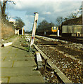
Huyton Station about 1970 - Wigan slow line just taken up
The flagged pathway led from platform 4 to Poplar Bank, where there was a bus terminal for the no 75 bus. Before the track was lifted trains to Wigan North Western had gone this way, but from this time onwards would be diverted over the fast lines. A DMU approaches from Manchester or Wigan.
Image: © John Martin
Taken: Unknown
0.15 miles


