IMAGES TAKEN NEAR TO
Cringles Drive, PRESCOT, L35 1RP
Introduction
This page details the photographs taken nearby to Cringles Drive, L35 1RP by members of the Geograph project.
The Geograph project started in 2005 with the aim of publishing, organising and preserving representative images for every square kilometre of Great Britain, Ireland and the Isle of Man.

There are currently over 7.5m images from over14,400 individuals and you can help contribute to the project by visiting https://www.geograph.org.uk
Image Map
Images are licensed for reuse under creativecommons.org/licenses/by-sa/2.0
Notes
- Clicking on the map will re-center to the selected point.
- The higher the marker number, the further away the image location is from the centre of the postcode.
Image Listing (12 Images Found)
Images are licensed for reuse under creativecommons.org/licenses/by-sa/2.0
Image
Details
Distance
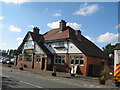
4
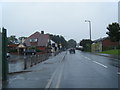
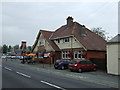
The Old Smithy, Cronton Road
The Old Smithy at the junction of Cronton Road with Whitefield Lane, dated 1836 with the name William Roscoe.
Image: © Sue Adair
Taken: 17 May 2007
0.12 miles
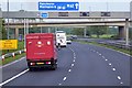
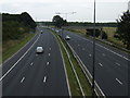
6
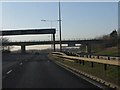
M62 motorway - Whitefield Lane overbridge
Image: © Peter Whatley
Taken: 17 Jan 2012
0.12 miles
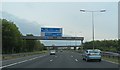
10
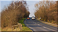
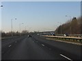
Whitefield Road climbs towards a bridge over the M62
Image: © Ian Greig
Taken: 2 Mar 2012
0.23 miles