IMAGES TAKEN NEAR TO
Netherley Road, PRESCOT, L35 1QE
Introduction
This page details the photographs taken nearby to Netherley Road, L35 1QE by members of the Geograph project.
The Geograph project started in 2005 with the aim of publishing, organising and preserving representative images for every square kilometre of Great Britain, Ireland and the Isle of Man.

There are currently over 7.5m images from over14,400 individuals and you can help contribute to the project by visiting https://www.geograph.org.uk
Image Map
Images are licensed for reuse under creativecommons.org/licenses/by-sa/2.0
Notes
- Clicking on the map will re-center to the selected point.
- The higher the marker number, the further away the image location is from the centre of the postcode.
Image Listing (13 Images Found)
Images are licensed for reuse under creativecommons.org/licenses/by-sa/2.0
Image
Details
Distance
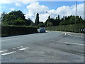
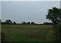
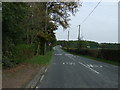
2
Netherley Road. Tarbock Green (B5178)
Heading south east.
Image: © JThomas
Taken: 13 Sep 2014
0.05 miles
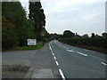
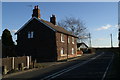
3
Lane through Tarbock Green
The bottom end of Water Lane where it is about to meet Netherley Road.
Image: © Bill Boaden
Taken: 31 Jan 2019
0.07 miles
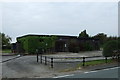
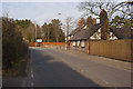
6
Greenbelt cottages
Between the conurbations of Widnes and Halewood.
Image: © David Long
Taken: 9 Feb 2006
0.13 miles
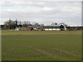
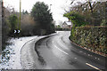
9
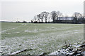
Frosty field by Marklands Farm
The farm is on the edge of the hamlet of Tarbock Green.
Image: © Bill Boaden
Taken: 31 Jan 2019
0.21 miles