IMAGES TAKEN NEAR TO
Old Lane, PRESCOT, L35 0NF
Introduction
This page details the photographs taken nearby to Old Lane, L35 0NF by members of the Geograph project.
The Geograph project started in 2005 with the aim of publishing, organising and preserving representative images for every square kilometre of Great Britain, Ireland and the Isle of Man.

There are currently over 7.5m images from over14,400 individuals and you can help contribute to the project by visiting https://www.geograph.org.uk
Image Map
Images are licensed for reuse under creativecommons.org/licenses/by-sa/2.0
Notes
- Clicking on the map will re-center to the selected point.
- The higher the marker number, the further away the image location is from the centre of the postcode.
Image Listing (8 Images Found)
Images are licensed for reuse under creativecommons.org/licenses/by-sa/2.0
Image
Details
Distance
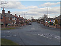
1
The junction of Blundell's Lane and Mill Lane
Image: © Sue Adair
Taken: 12 Jan 2012
0.01 miles
5
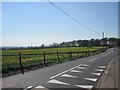
Blundell's Lane
Fields of rapeseed at Blundell's Lane with Blundell's Hill Wood on the skyline.
Image: © Sue Adair
Taken: 28 Mar 2019
0.20 miles
8
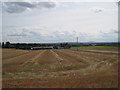
Rainhill Hall Farm
This farm is built on the site of Rainhill Hall a 14th century moated manor house constructed around a courtyard and owned by the Lancaster family, very little of the original building remains. On the 1849-1850 Lancashire map it was still labelled as Rainhill Hall. The building was listed a hundred years later and although already converted to a farmhouse, many ancient features survived at that time.
Image: © Sue Adair
Taken: 24 Aug 2014
0.24 miles