IMAGES TAKEN NEAR TO
Owen Road, LIVERPOOL, L33 7YP
Introduction
This page details the photographs taken nearby to Owen Road, L33 7YP by members of the Geograph project.
The Geograph project started in 2005 with the aim of publishing, organising and preserving representative images for every square kilometre of Great Britain, Ireland and the Isle of Man.

There are currently over 7.5m images from over14,400 individuals and you can help contribute to the project by visiting https://www.geograph.org.uk
Image Map
Images are licensed for reuse under creativecommons.org/licenses/by-sa/2.0
Notes
- Clicking on the map will re-center to the selected point.
- The higher the marker number, the further away the image location is from the centre of the postcode.
Image Listing (7 Images Found)
Images are licensed for reuse under creativecommons.org/licenses/by-sa/2.0
Image
Details
Distance
2
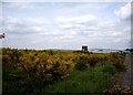
Gorse growing on Industrial Estate,Kirkby
Image: © Tom Pennington
Taken: 23 May 2008
0.13 miles
3
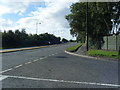
Hornhouse Lane, Kirkby Industrial Estate
Image: © Mike Pennington
Taken: 11 Jul 2016
0.21 miles
4
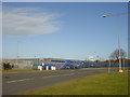
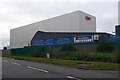
QVC Call Centre and Warehouse, Cooper's Lane, Kirkby
The vast QVC Knowsley call centre and warehouse complex on Cooper's Lane, Kirkby.
Image: © Sue Adair
Taken: 15 Feb 2006
0.21 miles
5
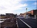
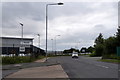
Entrance to KME copper tube factory
This was once IMI Yorkshire Imperial Metals, where I worked for sixteen years. The office block on the left still remains ,but a large building called East Mill has been demolished as well as the casting shop out of view on the right
Image: © Raymond Knapman
Taken: 15 Nov 2010
0.23 miles
6
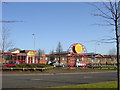
Knowsley Business Resource Centre
Knowsley Business Resource Centre on Admin Road at the entrance to Knowsley Industrial Park, photo taken from South Boundary Road.
Image: © Sue Adair
Taken: 15 Feb 2006
0.24 miles