IMAGES TAKEN NEAR TO
Meadway, LIVERPOOL, L31 8AX
Introduction
This page details the photographs taken nearby to Meadway, L31 8AX by members of the Geograph project.
The Geograph project started in 2005 with the aim of publishing, organising and preserving representative images for every square kilometre of Great Britain, Ireland and the Isle of Man.

There are currently over 7.5m images from over14,400 individuals and you can help contribute to the project by visiting https://www.geograph.org.uk
Image Map
Images are licensed for reuse under creativecommons.org/licenses/by-sa/2.0
Notes
- Clicking on the map will re-center to the selected point.
- The higher the marker number, the further away the image location is from the centre of the postcode.
Image Listing (5 Images Found)
Images are licensed for reuse under creativecommons.org/licenses/by-sa/2.0
Image
Details
Distance
2
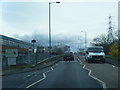
Old Racecourse Road
This ordinary looking road in Maghull has some history to it, as its name would suggest. In fact this is where the first Grand National was held in 1836. It was won by The Duke ridden by Captain Martin Becher who the famous fence Becher's Brook was named after-won the race in 1836 and 1837. It moved to Aintree in 1840.
Image: © Peter Hodge
Taken: 24 Dec 2005
0.04 miles
3
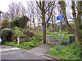
Old Racecourse Road, Maghull
At the junction with Sefton Road. The first three Grand Nationals (from 1836 to 1839) were run on a course here before the event moved to Aintree.
Image: © Mike Pennington
Taken: 23 Jul 2009
0.22 miles
4
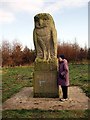
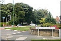
Stone Owl
This stone owl is hidden among the trees of Jubilee Wood.
On each face of the plinth is the following.
Lancashire County Council, Northwest Development Agency.
Cumbrian County Council, Queen's Golden Jubilee.
Merseyside, Jubilee Woods Trust.
Cheshire County Council, Forestry Commission.
Image: © Norman Caesar
Taken: 15 Jan 2012
0.22 miles